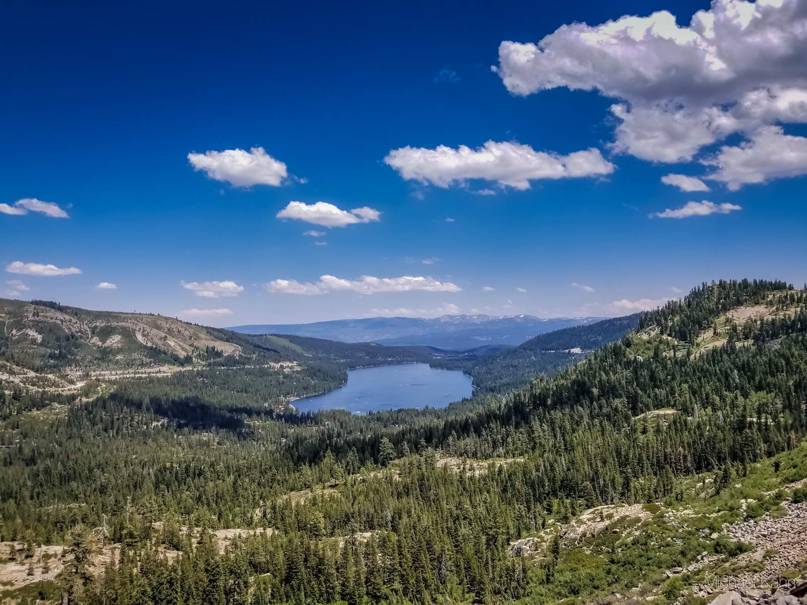
The Donner Pass Summit Tunnel Hike is an out-and-back trail overlooking Donner Lake and is one of the most unique hikes in Northern California.
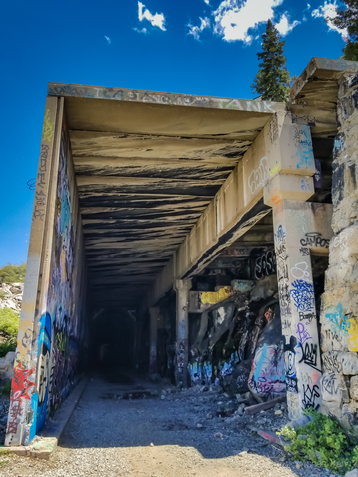
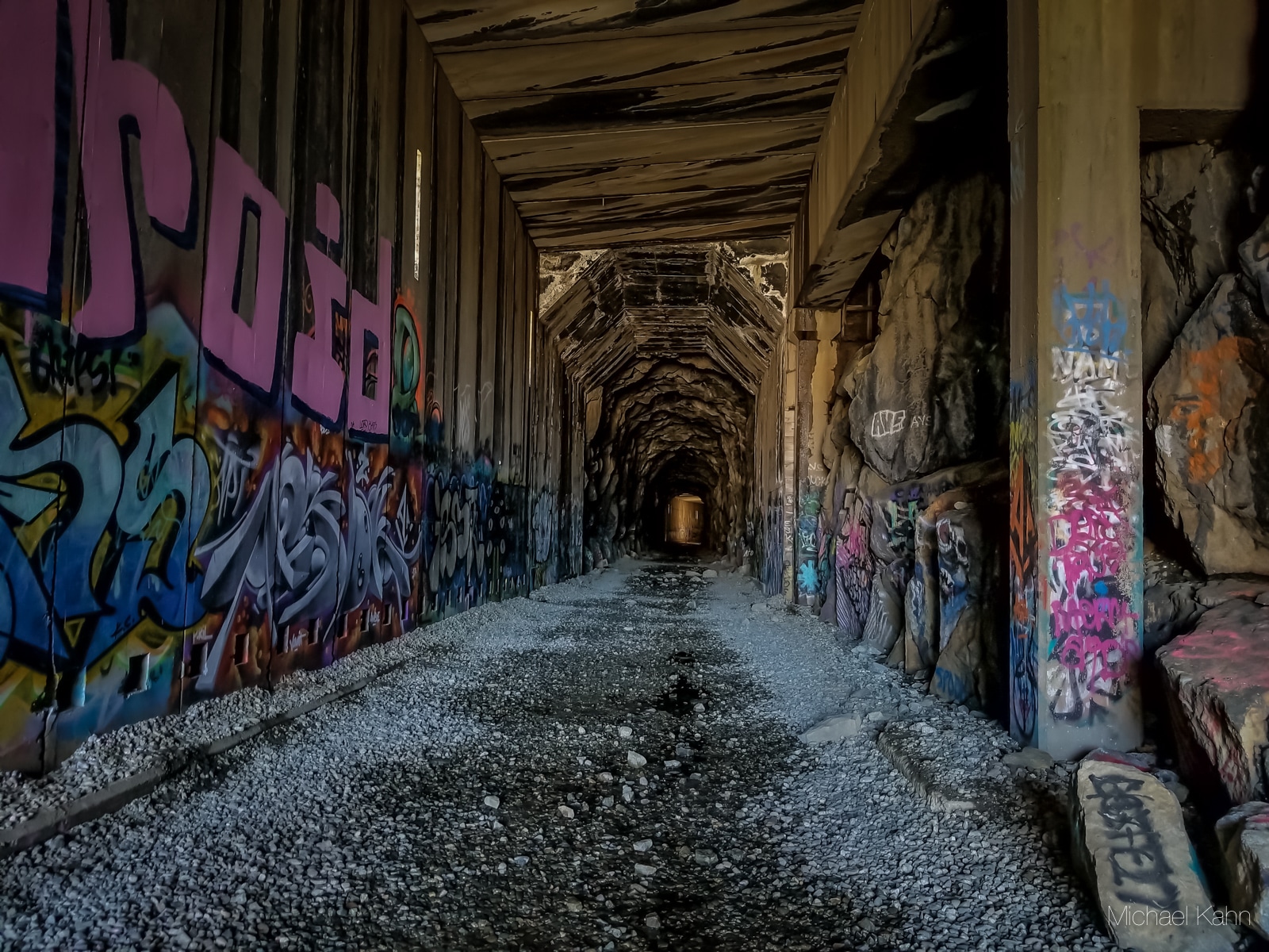
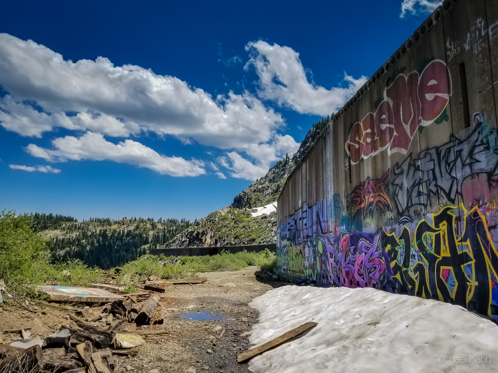
This easy-to-moderate trail meanders through the tunnel system of the first railroad line to traverse the Sierra Nevada Range. If the history alone wasn’t enough to intrigue you, the amazing graffiti art that decorates every square inch of the tunnel walls is sure to pique your interest.

Table of Contents
Eager to explore more amazing hikes in California? Hike the North Table Mountain Ecological Reserve in Oroville to catch a glimpse of the majestic Phantom Falls.
Hiking Info
Location: Donner Pass Summit Tunnel at Donner Pass Rd and Sugar Bowl Rd near Sugar Bowl Resort
Parking: Free; Donner Pass Road to a large unmarked parking area (Google Maps Directions)
Distance: 5.2 miles out and back (to the end of the Chinese Wall and back)
Difficulty: Easy
Dogs: Allowed
Gear: SureFire LED Flashlight | Osprey Talon 22 Daypack | Adventure Medical Kit | Hydroflask Water Bottle
The Hike
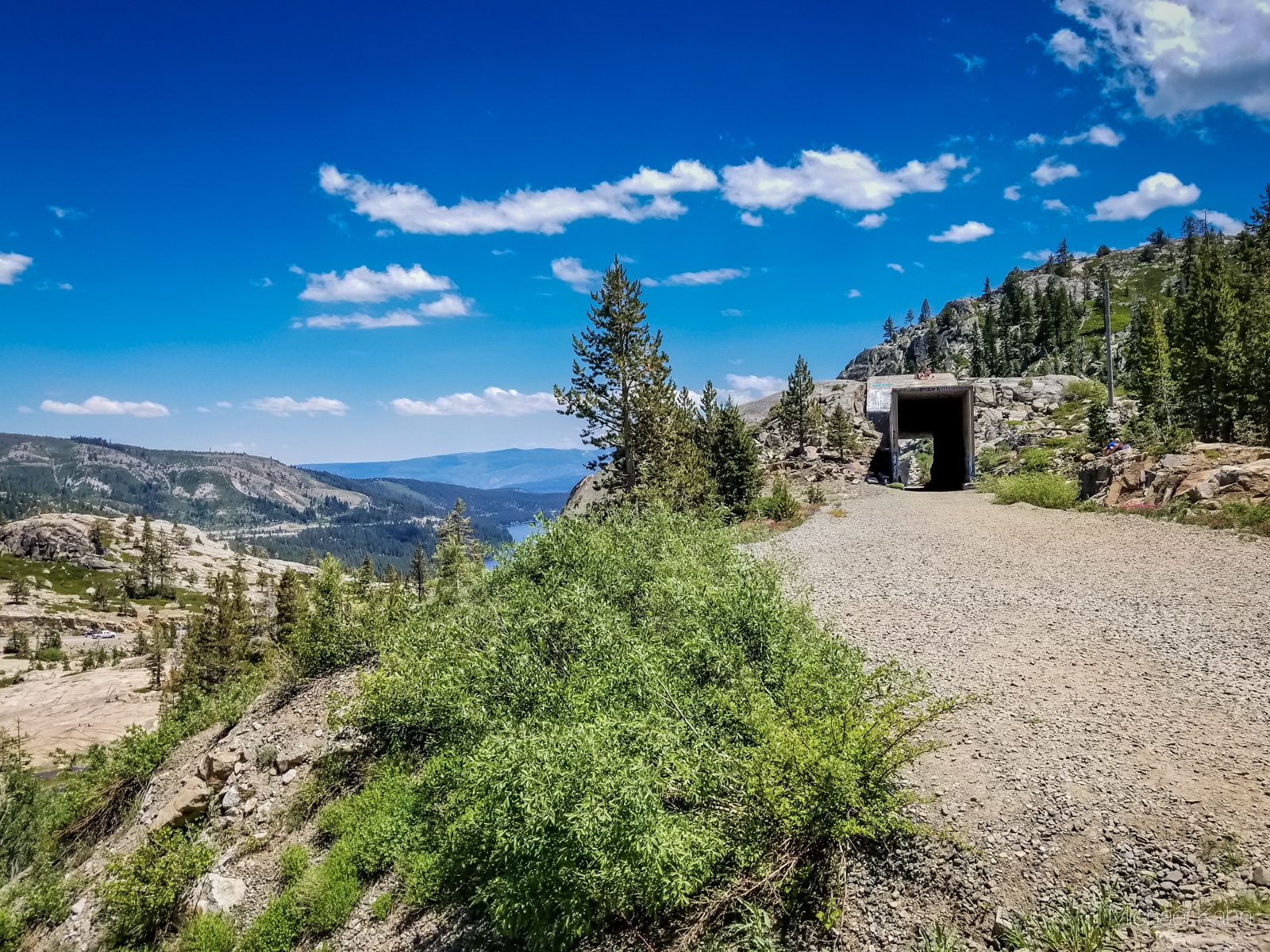
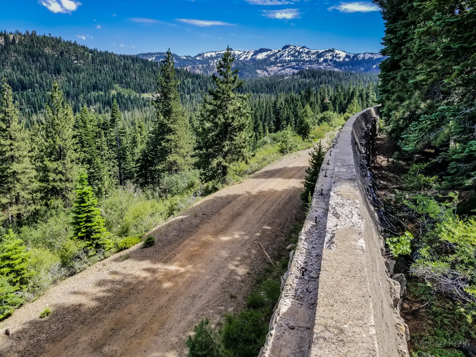
The Donner Tunnels hike takes you through a series of four railroad tunnels constructed in the 1860s, several miles of snow sheds, past petroglyphs, and past historic Chinese Walls. Throughout the hike, you will catch scenic views of Donner Lake and get a taste of graffiti subculture.


The tunnel portions of this trail remain cool in the summer heat, and this area does get snow in the winter. There are no toilets along the trail. As with most popular trails, it’s best to arrive early to avoid crowds.
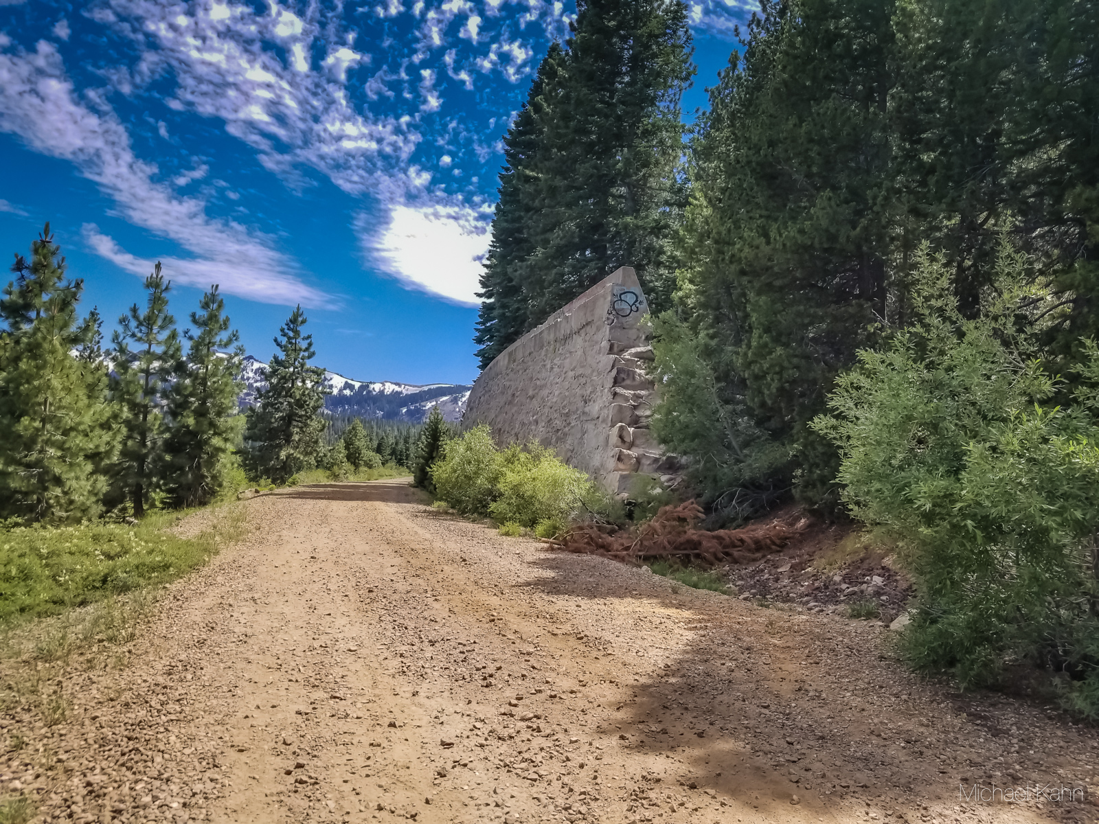
After turning off Sugar Bowl Road, you will find a short, windy dirt road that leads to a dirt parking lot with ample parking. From the parking lot, you can choose to follow a small dirt trail up to an informational placard about the area, or immediately start the hike by heading under the road.
TIP: If you want to cut a few miles off of your hike, you can continue about halfway up Donner Pass road and park at a turnoff near the Donner Summit Bridge. Head up the rocky hills to start the trail at the old China Wall.
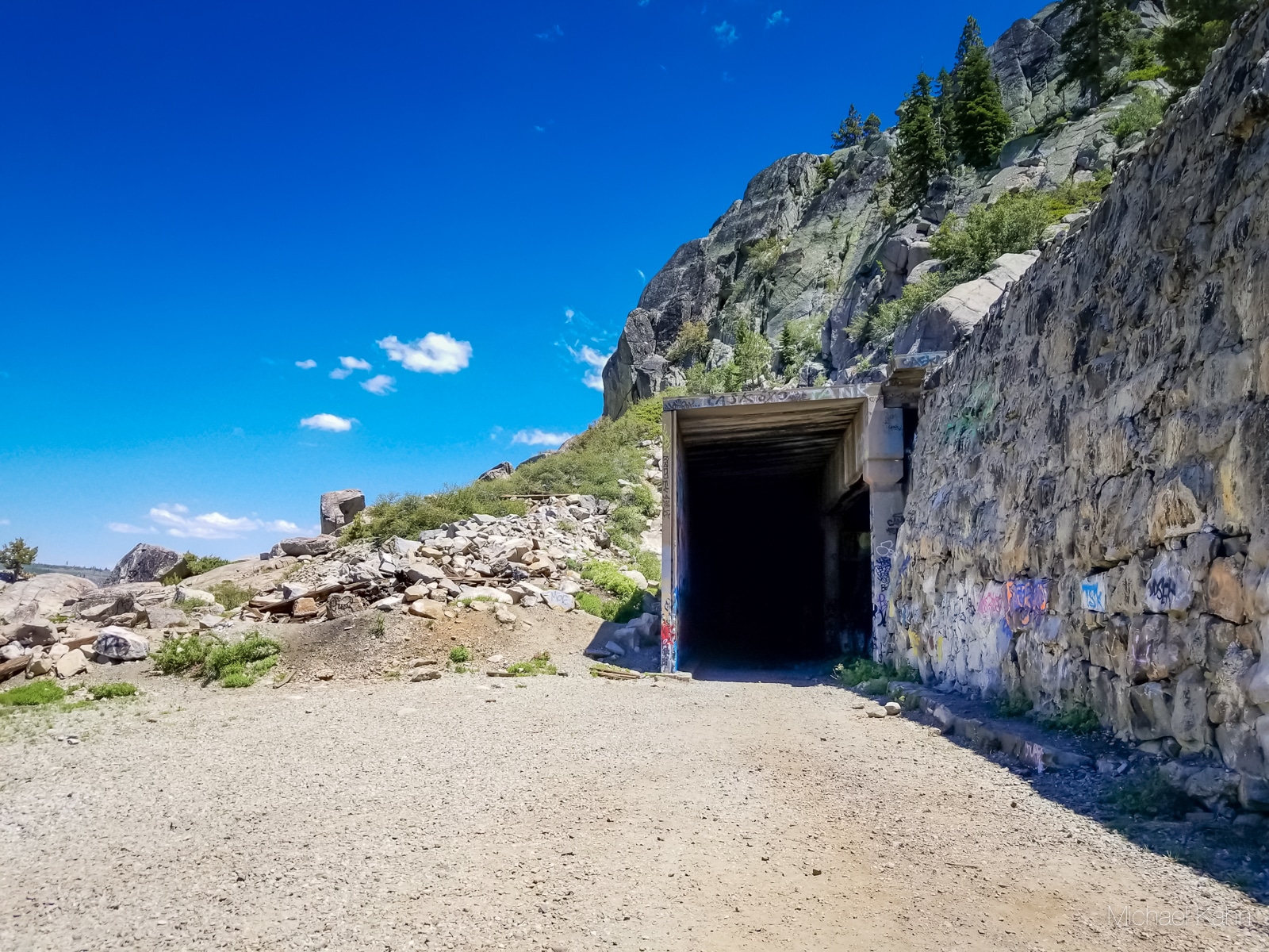
I passed through the somewhat ominous-looking gate to begin my trek into the past.
Overall, the hike is pretty easy on flat gravel, but there are a few uphill portions. At the time of my hike, there was a mudslide or avalanche which made the last third of the trail a bit more difficult to reach. This area near Sugar Bowl is infamous for deadly avalanches, so tread carefully should you choose to explore in the wintertime.
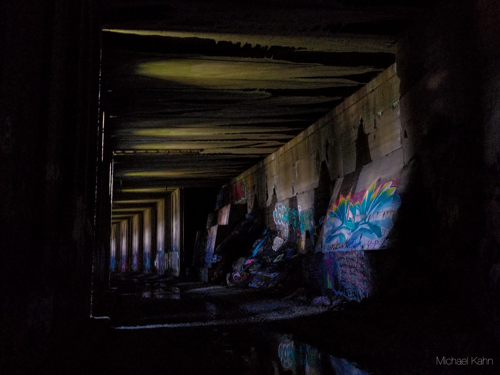
I highly recommend bringing a flashlight for walking through the tunnels. I use a 320-lumen flashlight which lit up the tunnels nicely. Headlamps didn’t quite do the job and many of the normal flashlights felt dim in the expansive tunnels. Technically, you can make the hike without light, but a few sections might be a bit hairy.


Speaking of hairy, if you are afraid of bats, this hike is definitely not for you. You will hear plenty of high-pitched squeaks from bats nestled away in the upper crevices. That said, I didn’t find too much guano covering the ground.
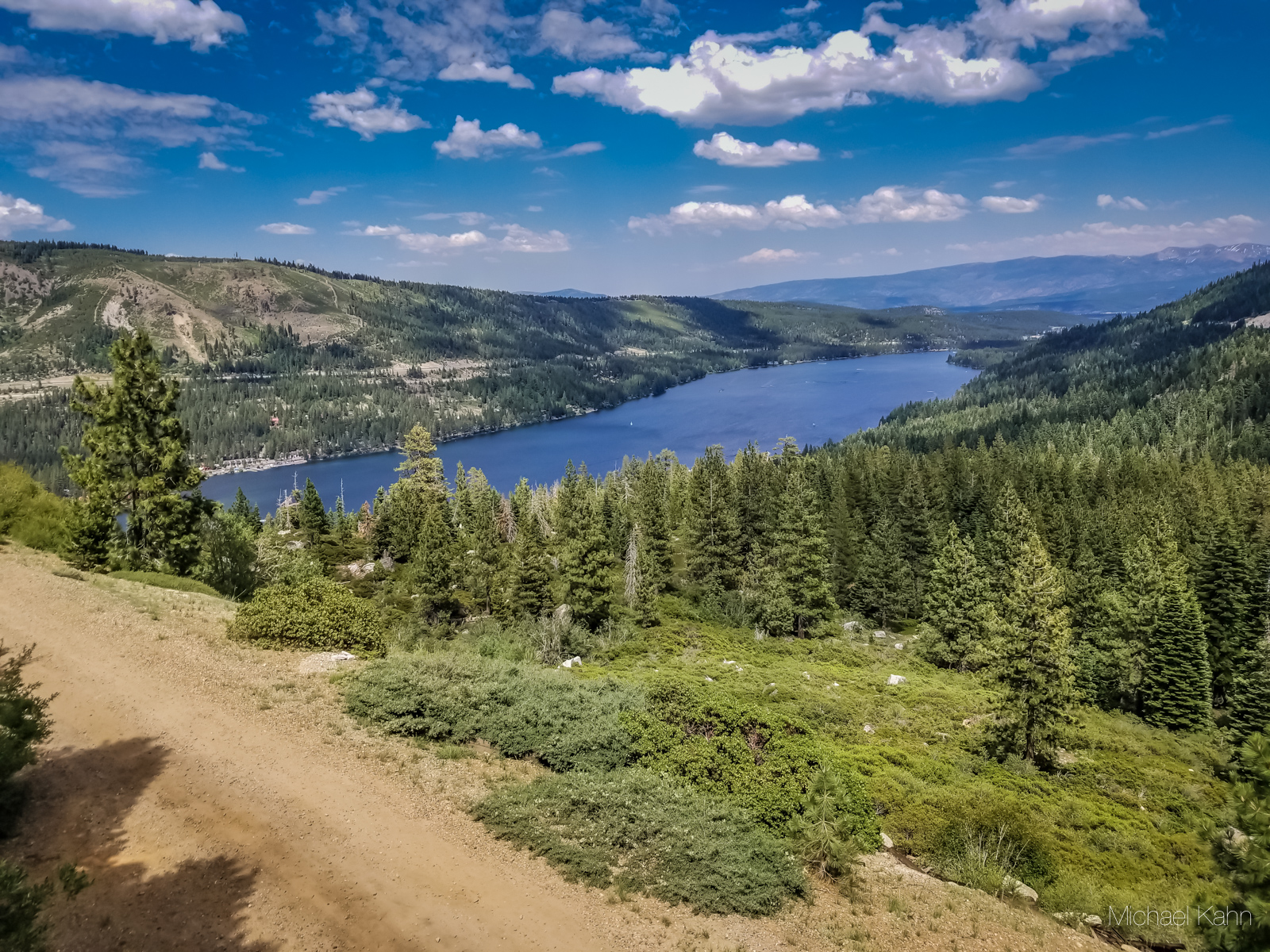
Beyond the first tunnel was a reprieve that provided wonderful views of Donner Lake, abuzz with boats and vacationers. Squinting through the trees, I could see the tunnels winding up through the distant mountains.
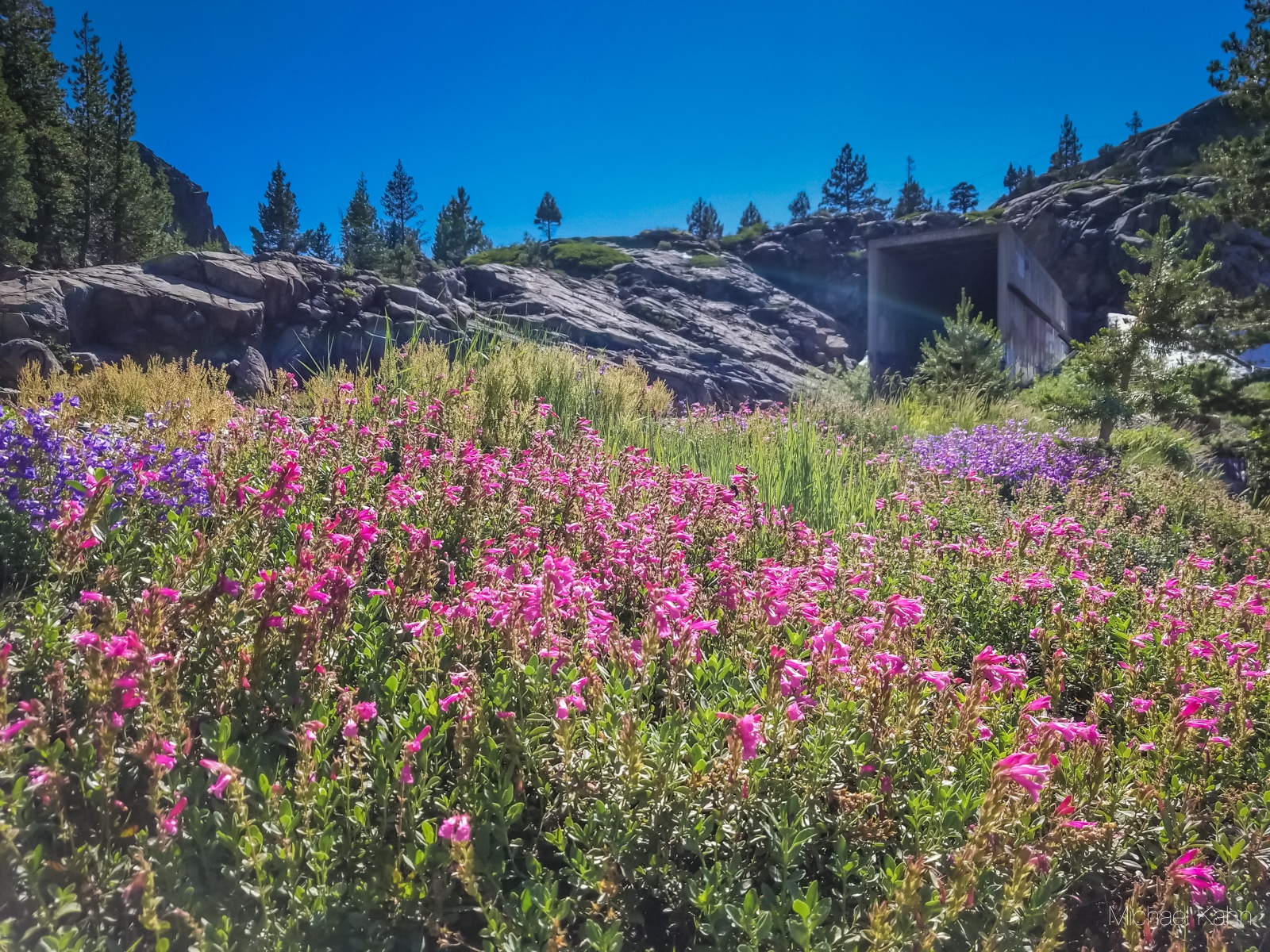
About 3.5 miles from the trail start, you will come across a placard marking ancient petroglyphs faintly carved into a large stone. Keep your eyes peeled, because they are easy to miss. In the same area, you will find a 75-foot-high hand-built Chinese Wall. This retaining wall was hand drilled and blasted by Chinese workers that came to work on the railroads.
After marveling at the craftsmanship of this wall, you can continue on through even more sections of the 1,659-foot-long tunnel. It’s amazing to look up in the tunnels and see centuries-old infrastructure and wood framing. The first train passed through this tunnel in 1868, and the final train passed through in 1993; A total of 125 years in service.
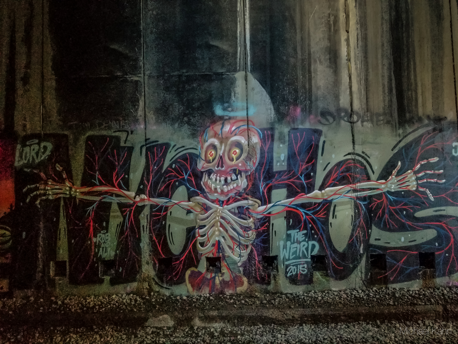
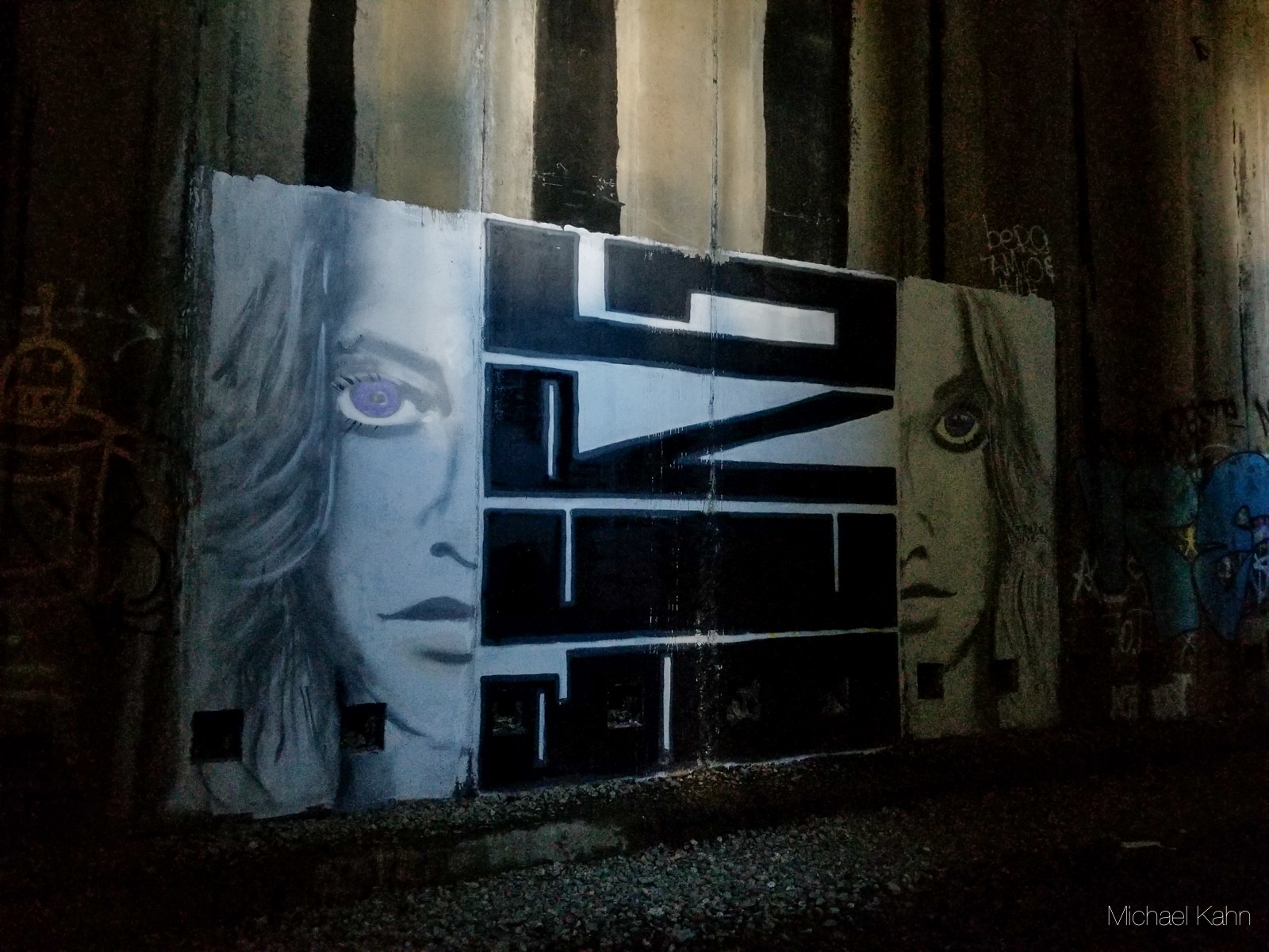
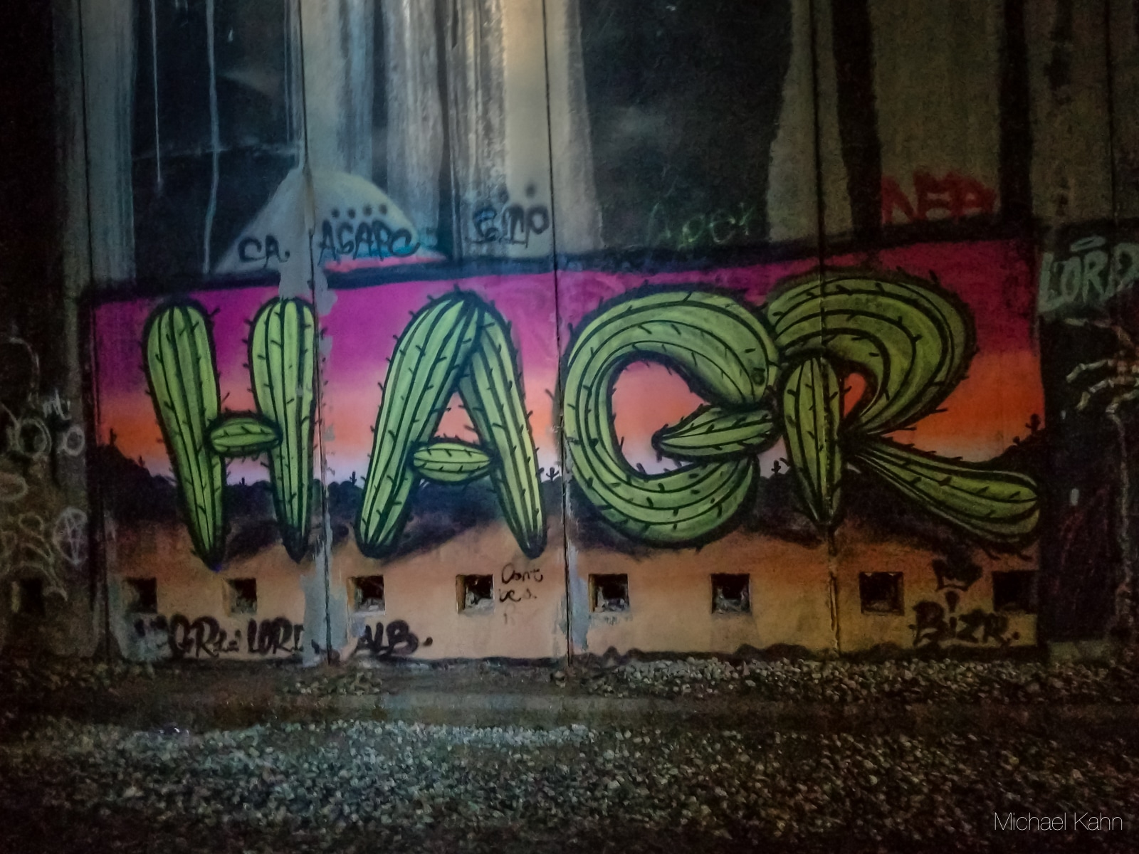
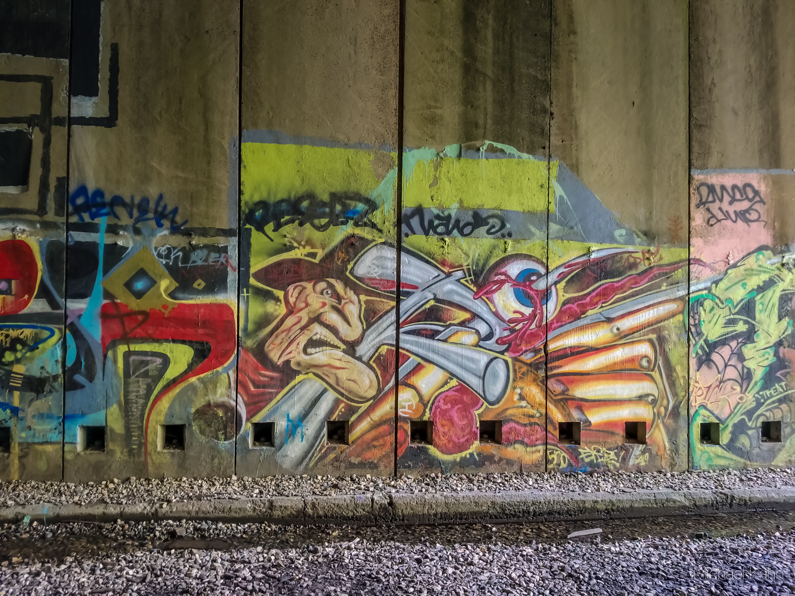

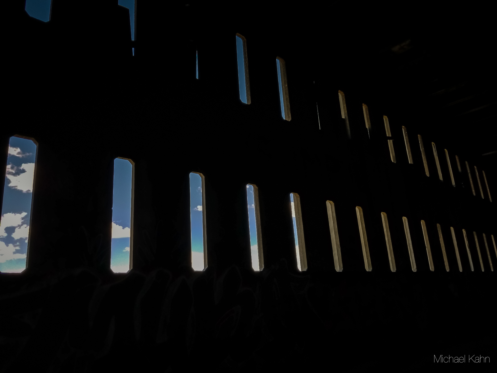
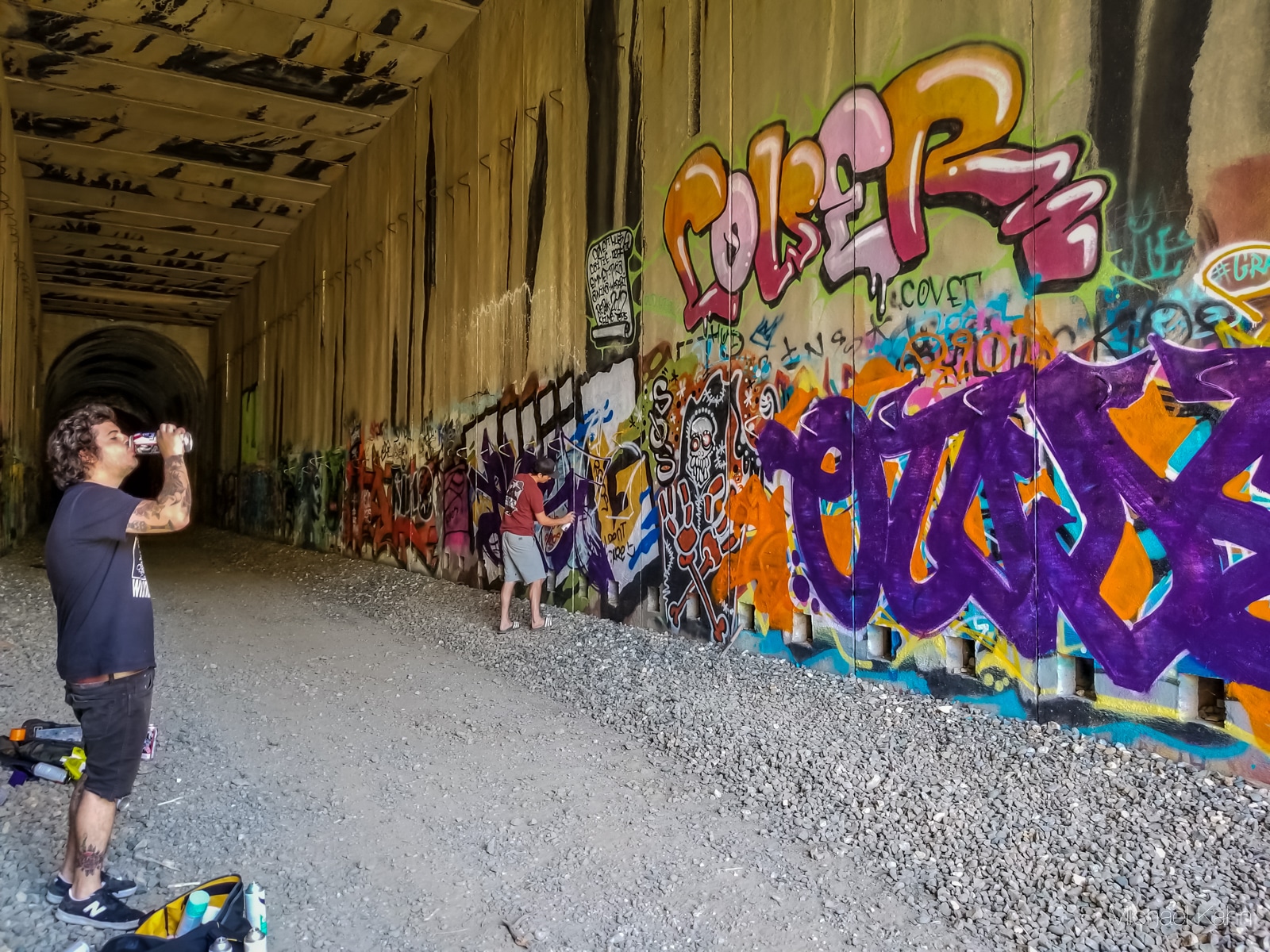
With the shorter tunnels out of the way, it was time to enter a much more ominous-looking tunnel. The way the light poured through the narrow ventilation windows was delightfully creepy. Graffiti reflecting in the pools of water was a sight to behold. Some truly amazing artists have left their mark on these tunnels. I even ran into a pair of graffiti artists planning out their design on an empty wall.
When I finally reached the end of the tunnels and emerged into the light again, I was greeted by a second Chinese Wall and more breathtaking views of the valley and lake below. I scaled the wall and took a breath, enjoying the cool breeze and sun on my face.
From this point, it was a fun walk back to the start. On the return leg of the hike, I took a short video to give you some idea of what walking through the Donner Pass tunnels sounds and feels like. Parts of the tunnel had a lot of snow on top that was melting fast in the hot July weather. This video shows a portion of the hike where it almost felt like rain.
I hope you enjoyed reading about this unique hike! If you visit the tunnels yourself, make sure to leave a comment below and tell me what you enjoyed about it.


Between the natural beauty and the man-made beauty, this looks like a perfect hike! And your photos are gorgeous. Thanks for sharing!
Mike, I love this adventure post! I never knew there was a tunnel to explore at Donner Pass. Your videos are fabulous. I feel like I’m right there seeing a bat, viewing the beautiful graffiti, and walking along that rugged path within the tunnel. Your adventures inspire me to get outside, drive somewhere new, explore the area and find hidden gems like this. Basically, your blog is a roadmap to adventure! Thanks for taking me along for the ride.