Explore the wonder of Lake Manly, part of Badwater Basin inside Death Valley National Park. Glean essential tips and insights for adventurers eager to discover the beauty of North America’s lowest point. From current conditions and where to stay to the best vantage point in order to experience the rare transformation of the prehistoric lake, this is everything you need to make your visit to Lake Manly a highlight of your life.
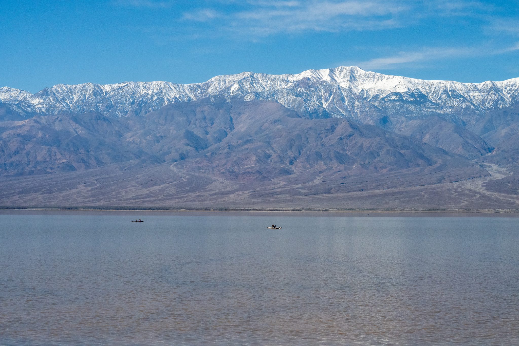
Table of Contents
Getting to the Lake
Lake Manly is located in Badwater Basin, Death Valley National Park, California. Badwater Basin, situated at Death Valley’s lowest point, holds the title for the lowest elevation in North America at 282 feet below sea level. Typically, it presents as a dry salt flat.
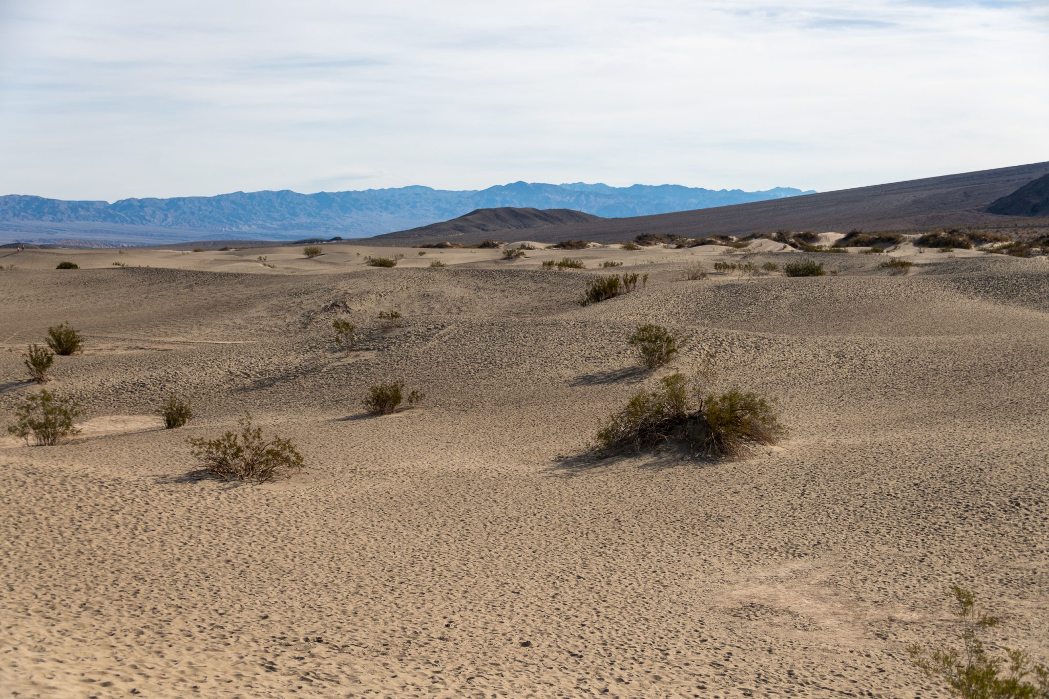
Google Maps: Trailhead and Parking Lot
Round Trip Length: 1 mile (1.6km) to edge of salt flat. Several hundred feet to the lake edge as of March 2024.
Round Trip Time: 40 minutes
Dificulty: Easy
Elevation Gain: Flat
Trail Type: Boardwalk then route, out and back
Location: Badwater Road, 30 minutes (17 miles/27km) south of Furnace Creek
Parking: Paved parking lot with large spaces for RVs and buses
Restroom: Vault toilet located in parking lot
Route: An ADA accessible ramp leads down to a wooden boardwalk. The walking surface is firm and wide beyond the boardwalk.
Note: Pets are not allowed on any trail in Death Valley National Park, even if carried. Do not leave your animal in your vehicle. Speak with a ranger about one of the incredible dirt roads where you may walk your pet.
Viewing the Lake
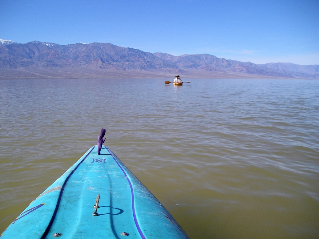
Park rangers encourage visitors to prioritize safety and reduce their environmental footprint by adhering to several guidelines. Parking lots might reach capacity, and those parking along road shoulders must be wary of soft shoulders and ensure their vehicle does not encroach on the driving lane. Footprints near the lake’s edge persist for years, so it’s important to stick to established paths and not create new ones, even for that perfect photo.
The park’s hotels and most campgrounds are open. Limited paved roads grant access to many of the park’s key attractions, including Manly Lake at Badwater Basin. The National Park Service continues its efforts to repair secondary roads, with many remaining closed due to flood damage. For the latest information, visit nps.gov/deva.
Sunrise
The lake is often cited as most stunning at sunrise. The gentle alpenglow is captivating, with the morning light turning the landscape pink and reflecting on the lake’s surface will make for an unforgettable experience. Mornings can be quite chilly, so remember to bring a jacket and layer for warmth.
Sunset
If you can, visit the lake while the moon is out. Clear skies and luminous moonlight can cast dramatic lighting along the white salt flats and encircle mountains in a surreal, hazy glow.
When the moon is absent or not as prominent in the sky, Death Valley will reward you you with a magnificent view of the stars above.
You’ll also encounter signifigntly less people at night. Bring a flashlight or headlamp with a red light to keep your nightvision intact.
Lake Conditions and Availability
Current park conditions and road map: https://www.nps.gov/deva/planyourvisit/conditions.htm
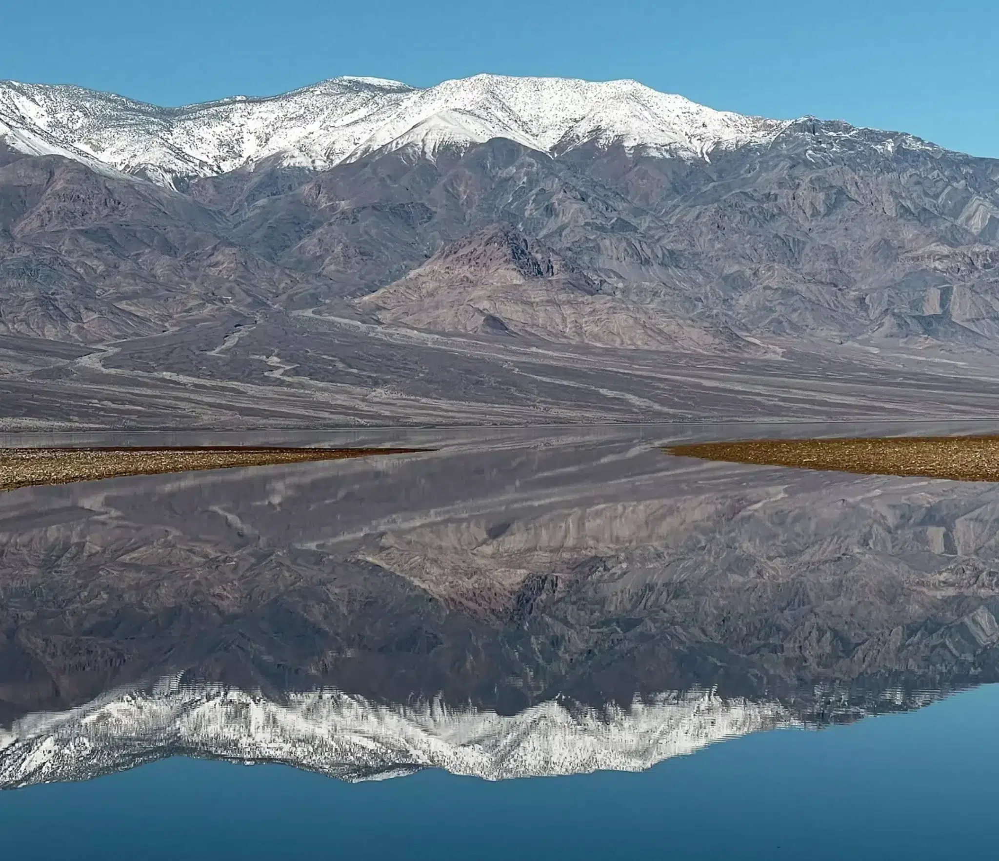
As of February 23, the lake can be kayaked or paddleboarded (Check out Paddleboard Accessories).
Lake Manly is currently 6 miles long, 3 miles wide and up to 2 feet deep in some places, as reported by NPS Rangers.
As of mid-February, Lake Manly spans approximately six miles in length, three miles in width, and maintains a depth of about one foot. While it may only support kayaking for a short period, park rangers anticipate that the shallow lake will continue to offer stunning reflective views through April, making it an exceptional time for visitors to experience the unique beauty of Death Valley National Park.
Significant rainfall in August 2023 transformed the valley floor into a wide, shallow lake. At its peak, the lake stretched approximately 7 miles in length and 4 miles in width, with a depth of two feet. By late January 2024, it had reduced to nearly half its original size, with its depth dwindling to mere inches.
Kayaks, Canoes, and Paddleboards
As of mid-February, kayaking and paddleboarding is doable. Expect the water to be muddy if its windy. You’ll come back from the water very salty with a lot of cleanup to do along with all of the sand and mud.
You’re going to feel very disgusting. The mud and salt is like no other, sticking and drying to you like cement. Bring a change of clothes, towels, bags to put dirty clothes and towels in, and multiple gallons of water to wash everything off.
This is not the kind of excursion where you will want to camp comfortably after. Quick access to a shower and a hotel room to clean yourself off in will be needed.
I’ve heard reports of one group attempting to canoe Lake Manly. While doable, it took walking the canoe out quite far to get it to a spot where it could actually be paddled. At least for a little bit.
Your best bet is to utilize inflatable watercraft to float higher in the water. The water is salty and dense, which does create a bit more buoyancy.
Barefoot is not advised, as the salt crystals will be sharp and cut your feet. Wearing flip flops or other open sandals can cause the same pain as you walk through the lake.
My Kayak Used:
Advanced Elements AirVolution Inflatable Kayak
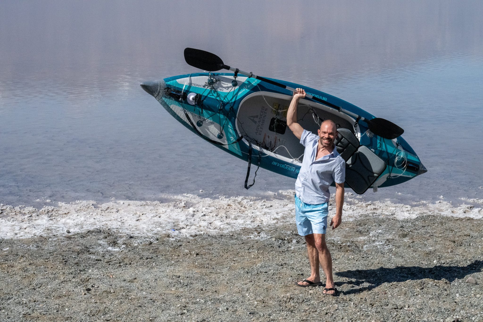
Read my blog post about kayaking the lake and learn how to have a successful trip of your own: Kayaking Death Valley National Park
Where to Stay
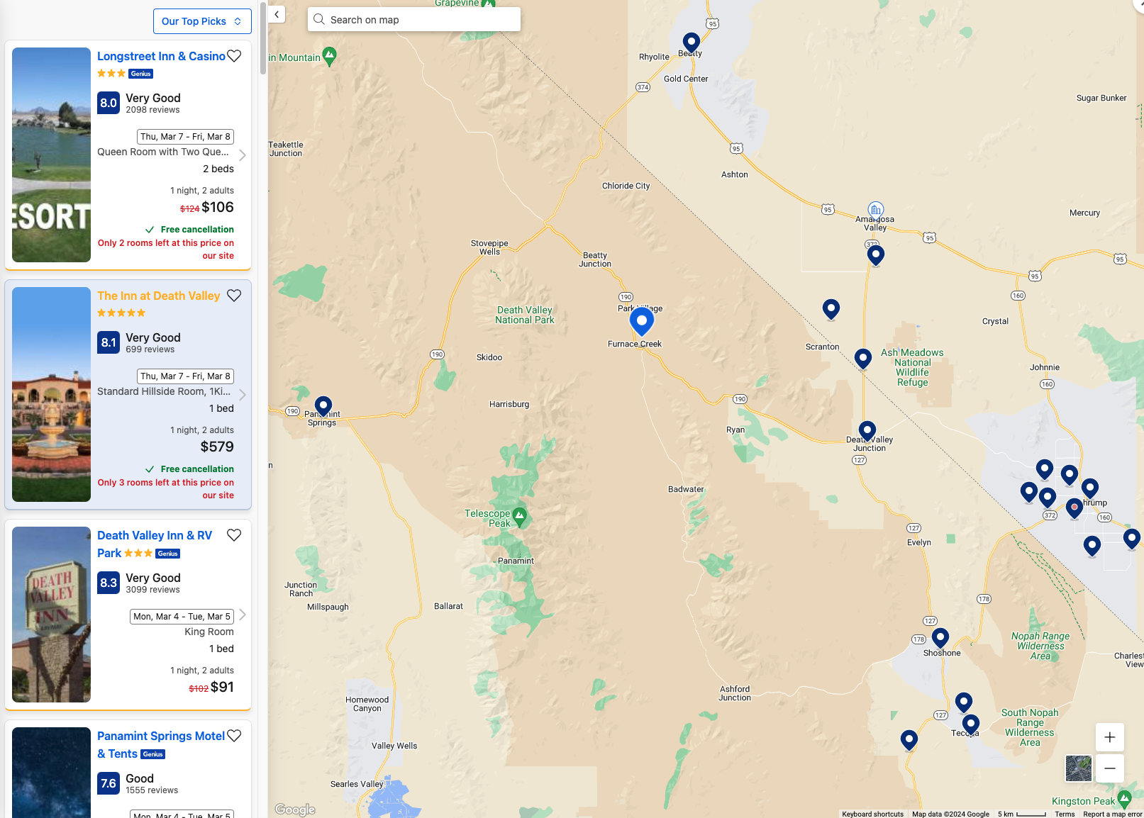
There are roughly 30 hotels/motels and campgrounds within an hour of the lake. Most properties are East and Southeast.
I always use Booking to reserve lodging for any of the locations around Death Valley. These are my top choices.
The Inn at Death Valley / Ranch at Death Valley is about 20 minutes from Lake Manly. These properties are my first choices, and unfortunately the most expensive.
The Inn boasts a 5-star resort hotel status, whereas the Ranch resembles a high-quality motel. The Inn offers exclusivity and excels in every aspect. Its mineral water pool, although enjoyable, often becomes busy with family gatherings.
The Casitas at the Inn require a lengthy uphill walk from the Main Lobby/Dining area. For easier access, enter through the ground floor beneath the main lobby, then take the elevator to the 2nd floor. The Casitas offer a tranquil atmosphere. Rooms at The Inn with west-facing views provide breathtaking sunset vistas over the Panamint and Cottonwood Mountains. Adjacent to the main lobby, a charming library houses a collection of vintage books about Death Valley.
Stovepipe Wells Village Hotel is 50 minutes away, about $200/night.
Longstreet Inn & Casino is about an hour drive and right on the Nevada border, about $100-$200/night.
Pahrump is about a 90 minute drive each way with several hotels and dining options. Expect to pay between $100-$400/night.
Tecopa is another option, with a few lodgings with hot springs. About 90 minutes away for around $100-$200/night.
The NPS has campground sites within minutes. These book up incredibly fast, with the draw of the rare and unusual lake. They are busy and fill up on normal, boring days, too. I recommend NOT trying to wing it.
Cellular signal and Wi-Fi in the park is slow and limited. At times, limited cell service can be found near The Ranch hotel and Stovepipe Wells Village. Some of the restaurants and hotels within the park offer Wi-Fi for an hourly price.
Lake Manly History and Topography
Lake Manly once sprawled across Death Valley, California, as a vast pluvial lake, covering the valley with a surface area of 1,600 square kilometers (620 sq mi) during the period known as the “Blackwelder stand.” Its water levels fluctuated over time, with the lake’s history further entangled by active tectonic shifts that altered the elevations of its shorelines.
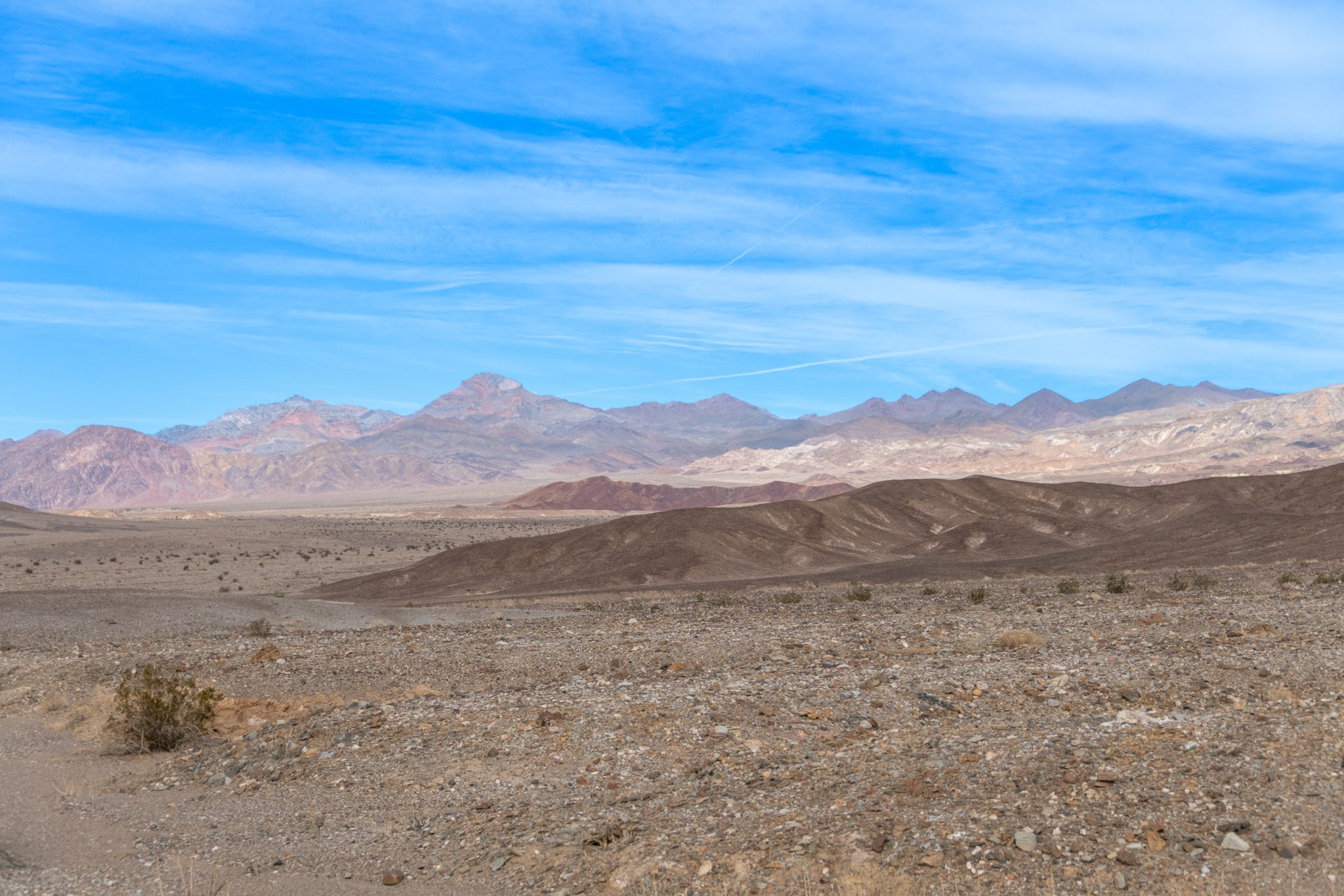
At the Blackwelder stage, these shorelines reached heights of 47–90 meters (154–295 ft) above sea level. Primarily fed by the Amargosa River, Lake Manly also received inflows from the Mojave and Owens Rivers at different times. It fostered a diverse aquatic ecosystem, supporting species such as lizards, pupfish, springsnails, and a variety of diatoms.
Throughout Death Valley’s geological history, lakes have appeared and disappeared. Following undefined stages in the Miocene, Pliocene, and early Pleistocene, the first significant lake phase emerged around 185,000–128,000 years ago during the Tahoe glacial stage, creating the Blackwelder shorelines. This phase marked Lake Manly’s largest known extent.
Theories suggest it might have merged with Lake Mojave to the south or even spilled into the Colorado River near Ludlow, though these ideas remain speculative. A subsequent, smaller lake phase occurred 35,000–10,000 years ago during the Tioga/Wisconsin glaciation. In the Holocene era, Lake Manly vanished, leaving behind only temporary lakes during periods of heavy flooding.
The lake is part of a series of significant lakes that developed in the Great Basin, with Lake Lahontan and Lake Bonneville among the most studied. Ice Age conditions, marked by cooler temperatures and reduced evaporation rates coupled with increased rainfall, led to the formation of these lake systems. Lake Manly served as a basin for overflow from several lakes, including Lake Tecopa, Mono Lake, Owens Lake, Searles Lake, Lake Panamint, Lake Mojave, Lake Dumont, and Lake Manix, though not all existed or contributed to Lake Manly at the same time.
Lake Manly received its name in tribute to William Lewis Manly, who famously led a group of immigrants to safety from Death Valley in 1849. The proposed name “Lake Rogers” for a potential northern lake in the same valley traces back to John Rogers, a colleague of Manly. The designation “Lake Manly” was officially adopted in 1932, though it occasionally appears misspelled as “Manley,” which is incorrect.
Alternative terms for the historical lakes in Death Valley include “Death Valley Pleistocene lakes” and “Death Valley Lake,” the latter first appearing in a 1902 publication.
Lake Manly emerged in Death Valley, a tectonic valley bordered by the Cottonwood Mountains and Panamint Range to the west, the Owlshead Mountains to the south, and the Black Mountains, Funeral Mountains, and Grapevine Mountains to the east. Spanning approximately 200 kilometers (120 mi) in length and 10–30 kilometers (6–19 mi) in width, Death Valley comprises three main basins: Badwater Basin, the lowest point in North America at 86 meters (282 ft) below sea level, Cottonball Basin, and Middle Basin.
The formation of Death Valley began around 14 million years ago, with significant development by the Pliocene era. The valley’s depth results from rapid vertical faulting, more so than anywhere else in the United States, with a geological history that includes rocks dating back to the Precambrian.
Death Valley’s active tectonic nature is evident through several faults, including the Black Mountains fault, Furnace Creek Fault, Grandview Fault, Northern Death Valley Fault, Southern Death Valley Fault, and Towne Pass Fault. This tectonic activity means that Lake Manly’s historical shorelines vary in elevation across different parts of the basin.
Ongoing faulting leads to a continuous decrease in the valley floor’s elevation, matching the rate of sedimentation, although precise rates remain uncertain. This geological activity causes the southwestern shores of Lake Manly to lower compared to the northeastern shores and, along with sedimentation, makes it challenging to determine Lake Manly’s depth accurately. The proximity of many lake deposits to the active faults in the Death Valley fault zone complicates this further.
Over the past 60,000–70,000 years, the Northern Death Valley fault zone has shifted by approximately 4.5–5 millimeters per year (0.18–0.20 in/year). The lack of recent earthquakes and dating data hampers the ability to gauge these faults’ activity accurately, despite a recorded earthquake in 1908 and ongoing subsidence in Death Valley.
Volcanic activity, including the formation of Ubehebe Crater within the valley and the more distant Mono-Inyo Craters, has shaped the landscape within the last 2,000 years.
The Amargosa River, once ending in Lake Tecopa, redirected into Death Valley and Lake Manly between 600,000 and 18,000 years ago, shifting from a potential path towards the Colorado River. During wetter periods, the Mojave River also contributed to Lake Manly, especially after breaching lakes like Lake Manix and Lake Mojave after 18,000 years ago.
The Owens River, forming 3.2 million years ago, channeled water into Lake Manly via Owens Lake and other basins during the Tahoe glaciation, significantly influenced by increased precipitation and glacier formation on the Sierra Nevada.
This network of rivers and lakes created a vast interconnected system, with Lake Manly at its core, significantly larger than today’s water flow. The system was fed not only by these rivers but also by streams from the surrounding mountains, primarily fueled by snowmelt.
Springs around the basin played a crucial role in early lake stages, contributing to the hydrology and stabilizing water levels, affecting the local water table.
Lake Manly was part of the Great Basin’s largest lake system, with a catchment area significantly influenced by geological shifts, climate changes, and a complex network of water sources, including rivers, streams, and springs, shaping its history and hydrology.
Around 12,000 years ago, Lake Manly had diminished to a mere 2 meters deep in the Badwater Basin, leading to the separation and evolutionary divergence of Cyprinodon fish populations. The lake’s recession, evidenced by well-preserved shoreline deposits like those at Hanaupah Fan, likely occurred more rapidly than its formation.
By 10,000 years ago, Lake Manly had disappeared, though traces of a Holocene-era lake suggest a brief resurgence between 5,000 and 2,000 years ago. This temporary lake, larger than Lake Mead, existed for likely under a century, with shorelines identified at elevations between -79 and -73 meters.
Today, Death Valley hosts only a small pond in Badwater Basin, characterized by a hot, dry climate, mudflats, and salt pans. Freshwater sources are limited to Salt Creek and a few springs, with the Mojave River’s floods never reaching the valley. The current climate and evaporation rates prevent the formation of lasting lakes in Death Valley.
Groundwater discharge now primarily sustains water in Death Valley. The Amargosa River, mostly subterranean, occasionally floods into the valley. Rare flooding events can temporarily resurrect parts of Lake Manly, as legend suggests, happening once every century.
Notably, severe flooding in March 2005 submerged parts of the valley, breaking precipitation records since 1911 and sparking a significant desert bloom, often linked to El Niño events.
Today, in 2024, rare weather events provide the opportunity to experience the prehistoric Lake Manly once more and even kayak on it.
Wildflowers
Death Valley is home to exceptional wildflower viewing. Blooming occurs between mid-February to mid-July throughout Death Valley, with lower elevations blooming first (if at all), followed by higher elevation flora later.
As of January, the best places to see flowers are Panamint Valley and Ubehebe Crater. Sprouts are starting to pop up near Furnace Creek Visitor Center and in washes throughout the park.
Mid-February to Mid-April: In the foothills and at lower elevations you may see desert Gold, Phacelia species, Golden Evening Primrose, Gravel Ghost, Bigelow Monkeyflower, and Desert Five-spot.
Early April to Early May: At mid-level elevations (3000 to 5000 ft.) and in canyons, you may find Desert Dandelion, Brittlebush, Desert Paintbrush, Fremont Phacelia, Mojave Aster, Bigelow’s Coreopsis, Indigo Bush, and Desert Globemallow.
Early May to Mid-July: At high elevations (5000 to 11,000 ft.) and on mountain slopes, you may find Desert Mariposa, Purple Sage, Rose Sage, Panamint, Magnificent Lupine, and Inyo Lupine.
Recent Death Valley Superblooms have occured in 2016, 2005, and 1998.
For details about some of the flowers you can spot in the park and throughout California, visit the California Super Boom article.
- About the Author
- Latest Posts
I strive to paint vivid landscapes with my words, bringing the magic of far-off lands and enchanting aromas to life for my readers. Combine passion for exploration and the art of gastronomy in an unending ode to the senses. When I’m not traversing the globe, I find solace in the earth beneath my fingertips, tending to my garden and working on projects around my verdant oasis. MK Library serves as a beacon, guiding fellow travelers and homebodies alike to embrace sustainability, nurturing both our planet and our souls with purpose. Full Bio.

