
Juniper Lake sits at 6,800 feet in the southeast corner of Lassen Volcanic National Park, the largest body of water in the park and the most remote of its drive-in lakes. For the 2026 season, it is also the lake you cannot reach. Juniper Lake Road from Chester has been closed since the 2021 Dixie Fire. Juniper Lake Campground remains closed for 2026 with no announced opening date. Mt. Harkness Fire Lookout, a 1930 stone-and-wood structure listed on the National Register of Historic Places in 2017 and rehabilitated by HistoriCorps volunteers in 2019, was destroyed in August 2021. Seven of the eight historic family cabins on the northwest shore burned the same week.
This guide tells you what Juniper Lake is, what was lost in the Dixie Fire, what survived, when access might return, and which Lassen lakes are open instead. Sources are NPS, USGS, recreation.gov, the Lassen Park Foundation, and CDFW. If you arrived here looking for the Florida Juniper Lake near DeFuniak Springs, that is a different lake managed by Walton County and is not covered here.

Key Takeaways
- Closed for 2026. Juniper Lake Road, Juniper Lake Campground, group sites, and the stock corral are closed with no announced reopening date per NPS Lassen Operating Hours.
- Mt. Harkness Fire Lookout was destroyed in the Dixie Fire on August 5, 2021. The 1930 structure was on the National Register of Historic Places. Only the stone foundation likely remains at the 8,046-foot summit.
- Seven of eight historic family cabins on the northwest shore burned the same week, along with one NPS work cabin. Juniper Lake Ranger Station survived because of fuel clearing.
- The lake holds no game fish per NPS. Bring a kayak; do not bring a fishing rod.
- Park entrance is now $30 per vehicle April 16 through November 30 ($10 winter). Lassen Volcanic went cashless on April 8, 2023. Bring a card; envelopes and exact change are no longer accepted.
- The road is 13 miles from Chester per NPS, with seven miles of gravel and six miles of rough pavement. NPS recommends high-clearance vehicles for the back six miles. Buses, motorhomes, and trailers are prohibited.
- Mt. Harkness Trail is 3.8 miles round-trip with 1,250 feet of elevation gain per NPS. Adding the Juniper Lake outlet section extends a hike to roughly 5.7 miles.
- Open Lassen lakes for 2026 include Manzanita (May 23 to October 7), Butte (May 30 to September 1), and Summit North and South (June 27 to September 8). Use the comparison table below to choose.
What Is Juniper Lake?
Juniper Lake is a 6,800-foot mountain lake in Lassen Volcanic National Park, California, named for the western juniper that grows on the surrounding volcanic flanks. Roughly 590 acres of cold deep water, it is the largest lake in the park and sits at the foot of Mt. Harkness, a basaltic shield volcano with a summit cinder cone. Access is via a 13-mile rough road from Chester. The lake holds no game fish and allows non-motorized boats only.
Current Status, 2026
NPS Lassen Volcanic Operating Hours, last updated November 17, 2025, lists Juniper Lake as closed; work in progress to re-open. Juniper Lake Road has been closed entirely since the 2024 summer season for post-fire recovery work. Juniper Lake Campground, the two group sites (A and B), and the stock corral all remain closed for 2025 and 2026 with no identified opening date.
Recovery work on this side of the park is slower than on the Warner Valley side. Drakesbad Guest Ranch and Warner Valley Campground reopened for the 2025 season after their own multi-year closures. Juniper Lake did not. The Juniper Lake side took more direct fire damage, sits at the end of a longer rough road, and serves a smaller volume of visitors than the front-country lakes.
Entrance fee, 2026
Per NPS Lassen Fees and Passes (checked May 5, 2026):
- $30 per private vehicle, April 16 through November 30, valid 7 consecutive days
- $10 per vehicle, December 1 through April 15
- $25 motorcycle (Apr 16 to Nov 30); $10 winter
- $15 per person on foot or bicycle (Apr 16 to Nov 30); $10 winter
- Lassen Annual Pass: $55, also covers Crater Lake, Whiskeytown, and Lava Beds
Cash and checks are no longer accepted at entrance stations. Lassen Volcanic transitioned to a cashless fee system on April 8, 2023. Bring a credit or debit card, an Annual Pass, or an Interagency Pass. Eight fee-free days in 2026 include Presidents Day (February 16), Memorial Day (May 25), the Independence Day weekend (July 3 through 5), and Veterans Day (November 11).
The Road from Chester
NPS describes Juniper Lake Road as a 13-mile route from Chester. Recreation.gov and Plumas County both clarify the surface: roughly six miles of rough pavement out of Chester, then seven miles of gravel that gets progressively narrower and rougher as you climb toward the lake. The pavement does not end at a clean transition. It thins to gravel patches first, then commits.
Sources disagree on what kind of vehicle should make the trip. NPS is firm: the road is “not suitable for cars with low clearance, buses, motorhomes, or trailers,” and “the final 6 miles require high-clearance vehicles.” Plumas County softens this to “passenger cars can make this route and many choose to do so” while still warning against buses, RVs, and trailers. Honor NPS in any decision that matters. Standard sedans do make the trip when the road is open, slowly and with attention to washboarding and pothole lines, but a sedan owner who scrapes a transmission pan on a rock at mile 11 has no recourse.
Drive 10 to 15 mph on the gravel section. Total travel time runs about an hour for the 13 miles when the road is open. Cell reception drops out as soon as you leave Chester city limits, so download offline maps before you go. Buses, motorhomes, and trailers are explicitly prohibited.
Operational season when the road is open is roughly June through October, weather permitting. Snow and post-melt mud close the route earlier and later than the lake itself ices over and clears. As of May 2026, the road is closed entirely for post-Dixie recovery, and there is no announced reopening date.
The Lookout We Lost
From August 1930 until August 2021, the Mt. Harkness Fire Lookout sat 8,046 feet above sea level on the basaltic shield that rises south of Juniper Lake. A 15-foot-square wooden cab perched on a roughly 12-foot stone tower, with a log catwalk and railings circling the cab. Inside was an Osborne fire finder and a panoramic photograph mounted to enable a lookout to map a smoke column to a real ridgeline in seconds. NPS Rustic Style architecture, locally quarried stone, milled timber. Ninety-one fire seasons of working operation.
National Register of Historic Places listing came in 2017. By then the cab had been weathered by nine decades of high-elevation winters and needed work. In summer 2019, HistoriCorps volunteers spent a season repointing the failing mortar, replacing deteriorated catwalk boards, repairing window trim, and refurbishing door frames. Photographs of that 2019 crew, smiling in front of a freshly stabilized lookout, are still on the Lassen Park Foundation site. They became a different kind of photograph two years later.
On August 5, 2021, the Dixie Fire crossed into Lassen Volcanic National Park at the southeast corner near Juniper Lake. National Parks Traveler reported the trajectory clearly: “Flames from the northern tip of the fire climbed up and over Mount Harkness and claimed the fire lookout tower there on its way towards Juniper Lake.” NPS confirmed the destruction in subsequent updates. A 1930 structure that had survived nine decades of lightning, blizzards, and the occasional rifle round from a confused hunter was gone in a single August day.
What is at the summit now is the foundation. Stone is harder to burn than wood. As of May 2026, NPS has not posted a formal damage assessment of the lookout footprint, and no rebuild project has been funded or announced by either the agency or the Lassen Park Foundation. If you eventually hike to the top once the trail and road reopen, expect to find the foundation stones, a scorched cinder cone summit, and the same panoramic view that justified building a lookout there in the first place. Mount Shasta to the north. Lake Almanor below. The Coast Range to the west on clear days, the Three Sisters in Oregon, and Nevada to the east.
The view is what was always free. Everything else has to be rebuilt or grieved.
The Lake Itself
Juniper Lake is not a glacial cirque. The famous cirque feature in this park sits on the northeastern flank of Lassen Peak. Juniper Lake instead occupies a basin shaped by Pliocene-to-Pleistocene andesite flows known to USGS mapping as the Juniper lavas, which moved roughly four miles westward from their source area approximately two million years ago. Mt. Harkness, the basaltic shield rising to the south, is one of four shield volcanoes at the corners of the Lassen central plateau (the others are Prospect Peak, Red Mountain, and Raker Peak). Each developed a cinder cone on its summit during a final eruptive stage. Mt. Harkness, Red Mountain, and Prospect Peak all erupted basalt; Raker Peak erupted andesite.
Glaciers in the Pleistocene reshaped the surrounding terrain without quite carving Juniper Lake’s basin into a textbook glacial form. Ice from Mt. Harkness and nearby Sifford Mountain fed downvalley to Warner Valley. What remained at Juniper Lake’s elevation is a basin walled on the south by the basaltic shield and on the north by the historic cabin shore, the lake’s outlet feeding eventually into the Feather River system.
Elevation: 6,800 feet at the standard NPS-cited figure. Some secondary sources cite 6,700 or 6,792, but NPS uses 6,800 across multiple pages and that is the figure the rewrite honors. The lake surface itself sits a few feet below the trailhead and ranger station bench.
Surface area: roughly 590 acres, the largest lake in Lassen Volcanic National Park. Specific surface-area and depth figures appear in regional historical and angling sources but were not directly verified against USGS National Hydrography Dataset records during this update; treat the 590 figure as approximate. The much-quoted “234 feet maximum depth” comes from regional secondary sources rather than USGS or CDFW lake records, so it stays here without a hard number attached.
Shoreline: roughly five miles around per Plumas County. The Juniper Lake Loop trail, which does not hug the water, runs 6.8 miles around the basin per the NPS map. The article’s older “4.7-mile kayaking perimeter” figure is a tighter line that excluded coves; five miles is the better total.
Fishery: none. NPS Lassen Fishing is unambiguous: Juniper Lake “does not contain any game species.” The Day Use page agrees: “There are no sport fish in the lake.” Plumas County concurs and warns against planning a fishing trip here. Whatever planting history or wild-trout rumor surfaces in older online forums is not supported by current CDFW stocking schedules or NPS guidance. If you want to fish in Lassen, head to Manzanita (catch-and-release “blue ribbon” fly fishery for rainbow and brown trout, single barbless hooks, lures and flies only), Butte, Snag, Horseshoe, or Echo. Skip Juniper Lake for any rod-and-reel trip.
Water clarity and temperature: cold and deep at 6,800 feet, with low cyanobacteria risk thanks to depth and remoteness. NPS swimming guidance for the park applies in full: there are no lifeguards in the park; even in summer, immersion in cold water can cause hypothermia. Manzanita Lake at 5,890 feet and 32 feet maximum depth has had cyanobacteria advisories in past seasons; Juniper, deeper and colder, has not had documented blooms.
The Cabins on the Northwest Shore
One of the threads that the Mt. Harkness Lookout obscures, because the lookout was the photograph everyone took, is that Juniper Lake had a cabin culture before it had a national park. In 1889, San Francisco speculator Elbert Dodge filed a 475-acre land claim on the northwest shore. In 1892, J.P. Frenna bought state-owned shoreline at $1.25 an acre. Between 1908 and 1909, three developers (Thomas A. Bragg, Justice Young, Alexander Thorne) filed water-rights claims trying to assemble a hydroelectric project at the lake; that scheme failed because no major streams supplied enough flow to be useful.
Cabins went up over the decades that followed. Lassen Volcanic National Park was established in 1916, but park boundaries grew to incorporate land that already had private structures on it. Eight cabins on the northwest shore stayed in private hands under grandfather rights, passed down through families for generations. Park Superintendent Jim Richardson described them in 2021 as “very important to the history of those families.” Some had been in the same family lineage for nearly a century when the Dixie Fire arrived.
Seven of the eight burned that August week. One survived. One NPS-owned cabin that “had a vital function as it accommodated crews that worked in that area of the park” also burned. Juniper Lake Ranger Station made it through because crews had completed fuel-clearing work around the building. The fire moved up over Mt. Harkness, took the lookout, and burned along the east side of Juniper Lake. The east shore had less defense than the cabin shore.
That detail (a century of family use, ended in a single week, with one cabin and one ranger station spared) is not in any of the older trip reports about Juniper Lake. It is the kind of context that changes how the place reads. A national park that contains private cabins is rarer than a national park that does not. A national park that contains burned private cabins, with the ash now four years old, is rarer still.
Mt. Harkness Trail
NPS canonical numbers for the standard out-and-back to the summit:
- Distance: 3.8 miles round-trip
- Elevation gain: 1,250 feet
- Trailhead: parking area on the north side of Juniper Lake Ranger Station, on the road into the campground
- Difficulty: moderate
Older trip reports and at least one regional hiking site describe a longer 5.5- to 6-mile loop that combines the Mt. Harkness summit with portions of the Juniper Lake outlet trail back to the campground. Both versions are real. NPS describes the out-and-back as the standard hike. The longer combined loop adds about two miles and lets you finish at the lake instead of retracing the climb.
Climbing through what used to be a healthy red fir forest, you now climb through a Dixie Fire burn scar. NPS post-fire visitor guidance is direct about the hazards: falling trees and limbs, hidden stump holes, loose or falling rock, and standing dead trees that “will remain to fall naturally.” Standing snags are visible across the trail’s middle section. Wind events drop them. Hike on calm-weather days when the road and trail eventually reopen, and watch the canopy and the ground.
At 1.7 miles, a junction offers a left-turn ascent toward the Mt. Harkness summit and a right-turn route that drops toward Warner Valley or the Juniper Lake outlet. Going left, you climb the cinder cone that sits on top of the basaltic shield and reach the lookout footprint at the rim. The cone’s slope is loose and steep. The summit benchmark and the foundation stones of the 1930 lookout are at 8,046 feet.
Summit views, on clear days, reach Mount Shasta to the north, the Coast Range to the west, the Three Sisters in central Oregon, and Nevada’s high desert to the east. Lake Almanor sits in the basin south of the park. Look down and west to see Lassen Peak’s lava domes; look north and east to see Prospect Peak, Cinder Cone, and the Fantastic Lava Beds. With Juniper Lake Road currently closed, the summit is effectively inaccessible to day hikers in 2026 unless you stage a long backcountry approach from Warner Valley or Snag Lake.
For an Osprey-quality day pack to carry water, layers, and a first-aid kit on this hike when the road reopens, the Osprey Talon 22L is the same pack that ran with me on the original 2018 trip and is still in production. Pair it with a Black Diamond Spot 400-R rechargeable headlamp if there is any chance you will be on the cinder cone in fading light.
Juniper Lake Loop, Snag Lake, and Horseshoe Lake
Juniper Lake Loop Trail
This 6.8-mile loop circles the basin without hugging the shoreline, gaining and losing roughly 1,100 feet of elevation across the day. The trail meanders along a creek section, climbs through mixed conifer and red fir, and offers a spur into Horseshoe Lake. NPS does not feature the loop on its official day-hiking page (that page leans toward Manzanita-area trails), so the 6.8-mile and 1,100-foot figures are widely cited from regional trail guides rather than directly verified against an NPS publication. Treat them as close approximations.
Trailhead parking sits on the north side of Juniper Lake Ranger Station on the road into the campground, the same lot used for Mt. Harkness Trail. Heading toward Snag Lake first lets you tackle the slope before fatigue sets in. Inspiration Point and Crystal Cliffs sit along the loop as named viewpoints; specific mileages and elevations for those features are not posted on accessible NPS pages.
Snag Lake and the 1666 Cinder Cone Eruption
Snag Lake is roughly four to five miles from the Juniper Lake area as a backcountry day or overnight trip. Its origin story is the most quotable in the park. In 1666, basaltic andesite flows from Cinder Cone (the volcano just north of Snag Lake itself) dammed a small creek. Carbon dating of a quaking aspen stump caught in the lava margin and tree-ring dating of nearby Jeffrey pines together established the year. USGS Fact Sheet 023-00 lays out the dating chain. The same eruption sequence subsequently dammed the lake’s northern outlet to form Butte Lake. Water flows underground from Snag through the porous Fantastic Lava Beds to Butte; there is no surface stream connection.
Unlike Juniper, Snag Lake has fish. NPS lists “Butte Lake, Snag Lake, and Horseshoe Lake” as the three Lassen lakes hosting rainbow, brown, and brook trout. Backcountry permits are required for overnight trips into the Snag Lake basin, and you should consult the Lassen Wilderness Permit office for current bear-canister and food-storage requirements before heading in.
Horseshoe Lake (the Lassen one, not Mammoth)
Lassen’s Horseshoe Lake is a backcountry lake reached as a short spur off the Juniper Lake Loop or via a longer approach from Summit Lake. It also holds rainbow, brown, and brook trout per NPS Fishing.
This is a different Horseshoe Lake from the better-known one at Mammoth Mountain in the Eastern Sierra, where USGS has documented an active CO2 release zone on the order of 50 to 150 short tons per day. Trees over an area of roughly 170 acres around the Mammoth Horseshoe Lake have died from elevated soil CO2. That phenomenon is not happening at Lassen’s Horseshoe Lake. They are different geologic situations at different lakes with the same name. If a trip report or guidebook page about Horseshoe Lake mentions tree die-off and toxic gas, it is talking about Mammoth, not Lassen.
Wildlife, Wildflowers, and the Red Fir Belt
At 6,800 feet, Juniper Lake sits at the transition between the mixed conifer belt below 6,500 feet and the red fir (Abies magnifica) belt above 7,000. Red fir is the climax conifer here. NPS Trees and Shrubs notes mature red firs reach over 175 feet tall, with diameters of 30 to 50 inches and lifespans over 300 years. Mt. Harkness Trail, before the Dixie Fire, climbed through red fir on its lower mile, and through a more open subalpine community as it gained the cinder cone. Post-fire, the red fir component is significantly reduced; recovery on Sierra-Cascade red fir stands runs in the multi-decade range.
The lake is named for western juniper (Juniperus occidentalis), a hardy conifer that thrives in rocky, open volcanic soils on the lower flanks of Mt. Harkness and along the south shore. Juniper is fire-resilient compared to red fir, and a portion of the namesake junipers came through the burn intact.
Wildflower bloom timing
NPS Lassen Wildflowers documents bloom timing by elevation band:
- 5,600 to 7,000 ft: late May through July
- 6,500 to 7,500 ft: late June through early August
- 7,500 to 8,000 ft: late July through September
For Mt. Harkness Trail, which traverses 6,800 feet at the trailhead to 8,046 feet at the summit, peak bloom runs late June through early August in the lower meadows and late July into September on the cinder cone. Species named by NPS for the park as a whole include silverleaf lupine, mountain mules ear, snow plant, western wallflower, and California corn lily. At 6,800 feet, Juniper Lake sits in California’s late-spring and summer wildflower belt, well after the lower-elevation desert bloom has wrapped up. For the full statewide bloom calendar by region and elevation, see the California Super Bloom & Wildflower Guide.
Wildlife
NPS lists 57 mammal species and 216 bird species in the park, though specific Juniper Lake basin counts are not separately published. Black bears are present throughout the park, and food-storage requirements in the campground (when it reopens) require all food and scented products in the bear lockers at each site. Backcountry trips into Snag, Horseshoe, or Echo Lake currently require following the Wilderness Permit office’s bear-canister rules; check current requirements before each trip.
Mule deer are common at the lake’s edge in summer evenings; sleeping near the shore in the campground (when it operated) meant being woken by hoof-fall in the shallows. No specific osprey or bald eagle nesting record at Juniper Lake is published in NPS or CDFW sources I could verify; treat any third-party mention of confirmed raptor nesting as unverified.
Mountain Maidu Country
NPS Lassen Volcanic’s tribal acknowledgment is specific about which side of the park sits within which traditional territory. The Mountain Maidu controlled “the southern and eastern portions, including Warner Valley and Juniper Lake.” That is a different affiliation from the Atsugewi (north and northwest of the park, in the Hat Creek drainage) and the Yana and Yahi (west of the park, in the Mill Creek drainage).
The Lassen region as a whole was, per NPS, “a meeting place for the four indigenous groups, and the archaeological record reveals evidence of human activity here at least as far back as 7,500 years ago.” Lassen Peak itself carries the Mountain Maidu name Kohm Yah-mah-nee, “Snow Mountain,” which is also the name of the park’s main visitor center. Modern affiliated tribes for the Mountain Maidu include the Greenville, Enterprise, and Susanville Indian Rancherias.
This matters for a trip report on Juniper Lake because the basin sits squarely in Mountain Maidu seasonal use territory. Higher elevations were used in summer for hunting and gathering before descent to lower-elevation winter villages. The land is still spiritually significant to descendant communities. Visit accordingly when access returns: stay on trails, leave artifacts where you find them (federal law and respect both apply), and approach the place as a guest in someone else’s enduring homeland rather than as a discoverer.
Lassen Lake Comparison
If the question is “which Lassen lake should I visit,” and Juniper Lake is closed, this table answers the next several follow-up questions at once. Source data is NPS Lassen Operating Hours, Fishing, and Swimming pages, all checked May 5, 2026.
| Lake | Elevation | Access | Camping (2026) | Boating | Fishing |
|---|---|---|---|---|---|
| Juniper Lake | 6,800 ft | 13 mi rough road from Chester | Closed (since 2021) | Non-motorized only | None (no game fish) |
| Manzanita Lake | 5,890 ft | Front-country, paved | Open May 23 to Oct 7 | Non-motorized | Catch-and-release fly fishery (rainbow, brown) |
| Butte Lake | 6,060 ft | East entrance, paved | Open May 30 to Sept 1 | Non-motorized | Rainbow, brown, brook trout |
| Summit Lake (N+S) | 6,695 ft | Central, on Hwy 89 | Open Jun 27 to Sept 8 | Non-motorized | Has trout |
| Snag Lake | 6,070 ft | Backcountry hike-in | Permit required | Not practical | Rainbow, brown, brook |
| Horseshoe Lake | 6,500 ft | Backcountry hike-in | Permit required | Not practical | Rainbow, brown, brook |
| Echo Lake | ~7,000 ft | Backcountry hike-in | Permit required | Not practical | Has trout |
| Lake Helen | 8,200 ft | Roadside (Hwy 89) | None | Not practical | Not stocked |
| Boiling Springs Lake | 5,990 ft | Hike-in (Warner Valley) | None (hydrothermal) | Prohibited | None |
Decision guide
- If you want roadside lake access with full services: Manzanita Lake. Reservable campground, paved access, closest to the northwest entrance, blue-ribbon catch-and-release fly fishery.
- If you want a quieter front-country lake with good trout: Butte Lake on the east side, with Cinder Cone and the Painted Dunes a short hike away.
- If you want a centrally-located base camp: Summit Lake (north or south loops) on Highway 89.
- If you want backcountry trout lakes with effort: Snag, Horseshoe, or Echo Lake. Permit required.
- If you want the largest lake in the park, in remote silence, with no fishing: Juniper Lake, when it reopens. Currently closed for 2026.
- If you want a hot pool: Boiling Springs Lake in Warner Valley. Stay outside it. The water is acidic and entry is prohibited.
Where to Go Instead in 2026
Until Juniper Lake Road and Juniper Lake Campground reopen, three alternatives in Lassen Volcanic itself capture portions of the experience.
Manzanita Lake is the front-country answer. Open May 23 through October 7, 2026, it has reservable sites, a paved approach, the Loomis Plaza ranger services, and a catch-and-release rainbow and brown trout fishery that NPS calls “blue ribbon.” Single barbless hooks, lures and flies only. The lake is shallower (32 feet maximum depth) and warmer (62 to 68°F surface temperature in summer) than Juniper, with documented cyanobacteria advisories in some past seasons. It is busier. It is also accessible to almost any vehicle.
Butte Lake on the east side, open May 30 through September 1, captures the “lesser-known drive-in lake” character better than Manzanita. The east entrance road is paved but quiet. Cinder Cone and the Painted Dunes hike from Butte Lake is one of the best two-hour walks in California. Rainbow, brown, and brook trout are present.
Summit Lake on Highway 89 sits closest to the geometric center of the park. Open June 27 through September 8 in 2026, it has both north and south loops with reservable sites. From Summit Lake you can day-hike Lassen Peak, Bumpass Hell, and the Cluster Lakes basin without long drives.
If you want to paddle a Lassen lake in 2026 with a packable boat, the Intex Explorer K2 inflatable kayak packs into a duffel and inflates with a high-output hand pump in about ten minutes. It is not a sea kayak; it is a slow tandem cruiser appropriate for non-motorized lakes like Manzanita and Butte. Pair it with a USCG-approved Onyx MoveVent Dynamic Type III paddle vest and a Sea to Summit Big River 20L dry bag for camera, layers, and a sandwich.
A Night Paddle in 2018
What follows describes a trip taken before the Dixie Fire. Read it as historical context for what this place was and what it might be again, not as a current trip report.
I first found Juniper Lake in 2017. No kayaks that trip; just a quiet place to camp at the end of a long dirt road. Returning the next summer over Labor Day weekend, I came prepared with a friend, kayaks, and a cooler heavy with aluminum cans and snacks. (Glass stays at home for places like this.) Scoring the last available campsite on a holiday weekend at a first-come, first-served campground was its own small miracle. Plans for the trip were no plans.
We made sure our only plans were to have no plans…
An hour before sunset, we launched. Watching deer running along the rocky edge while waves lapped against the kayak hulls turned the basin into something unreasonably calm. Despite a full campground, the lake was big enough that we found a stretch of water to ourselves. Water clarity was striking; the bottom stayed visible at depth, then shifted to a sapphire blue as we paddled toward the center.
Reaching the middle of the lake just as the sun dropped behind the trees, we floated and ate dinner with our feet still in the boats. Time disappeared. Stars came out unobstructed by city light. Night kayaking on a small, motorless mountain lake is one of the few situations where I feel comfortable on water in the dark; you cannot get lost, no boats can come at you, and the moon is enough light to see the bottom from the surface.
Sleeping a few feet from the water meant being woken at intervals by mule deer hoofing through the shallows. One stood close enough that when I sat up, I startled it more than it startled me. Sunrise was the second-best paddle of the day: glassy water, smoke from coffee fires drifting across the campground, the campground itself still mostly asleep.

By the end of the weekend we were tired in the right way and quietly convinced that Juniper Lake might be one of the best lakes in Northern California to kayak. Three years after that trip, the Dixie Fire crossed Mt. Harkness, took the lookout, burned the cabins on the northwest shore, and closed the road. Whether that 2018 trip remains the best Juniper Lake experience I will ever have, or whether it ends up being a memory I tell my kids about before bringing them to a recovered lake in 2030, depends on the road, the campground reopening, and a forest’s slow return.
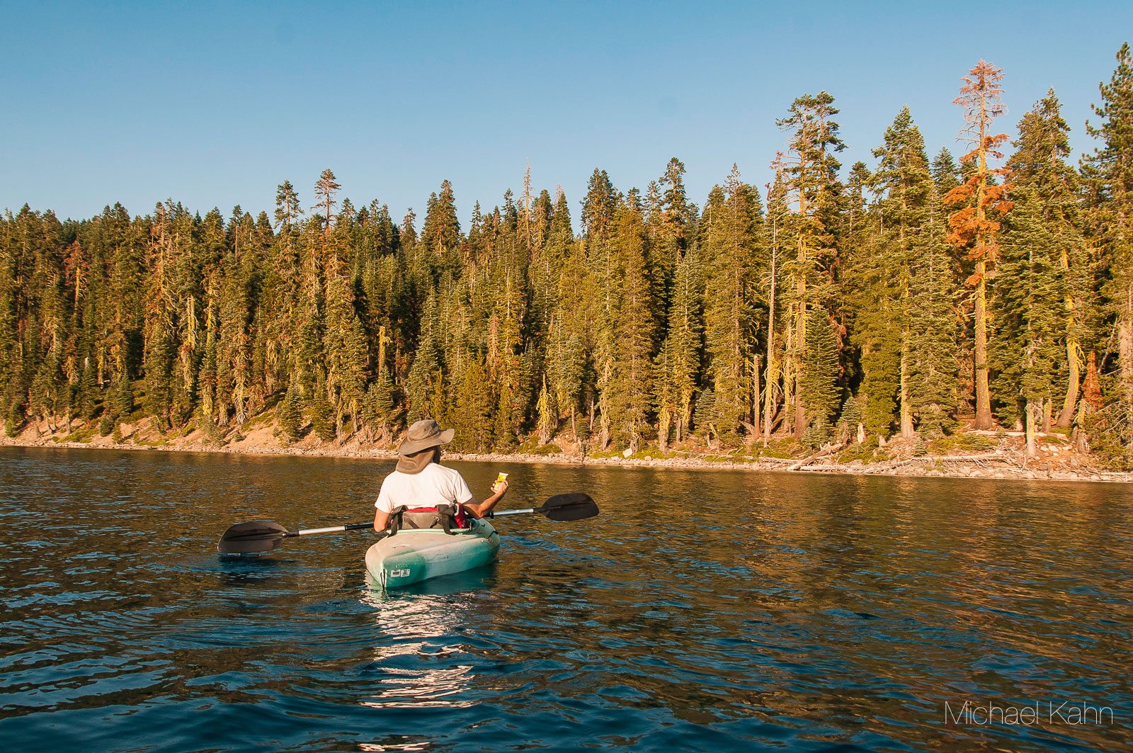
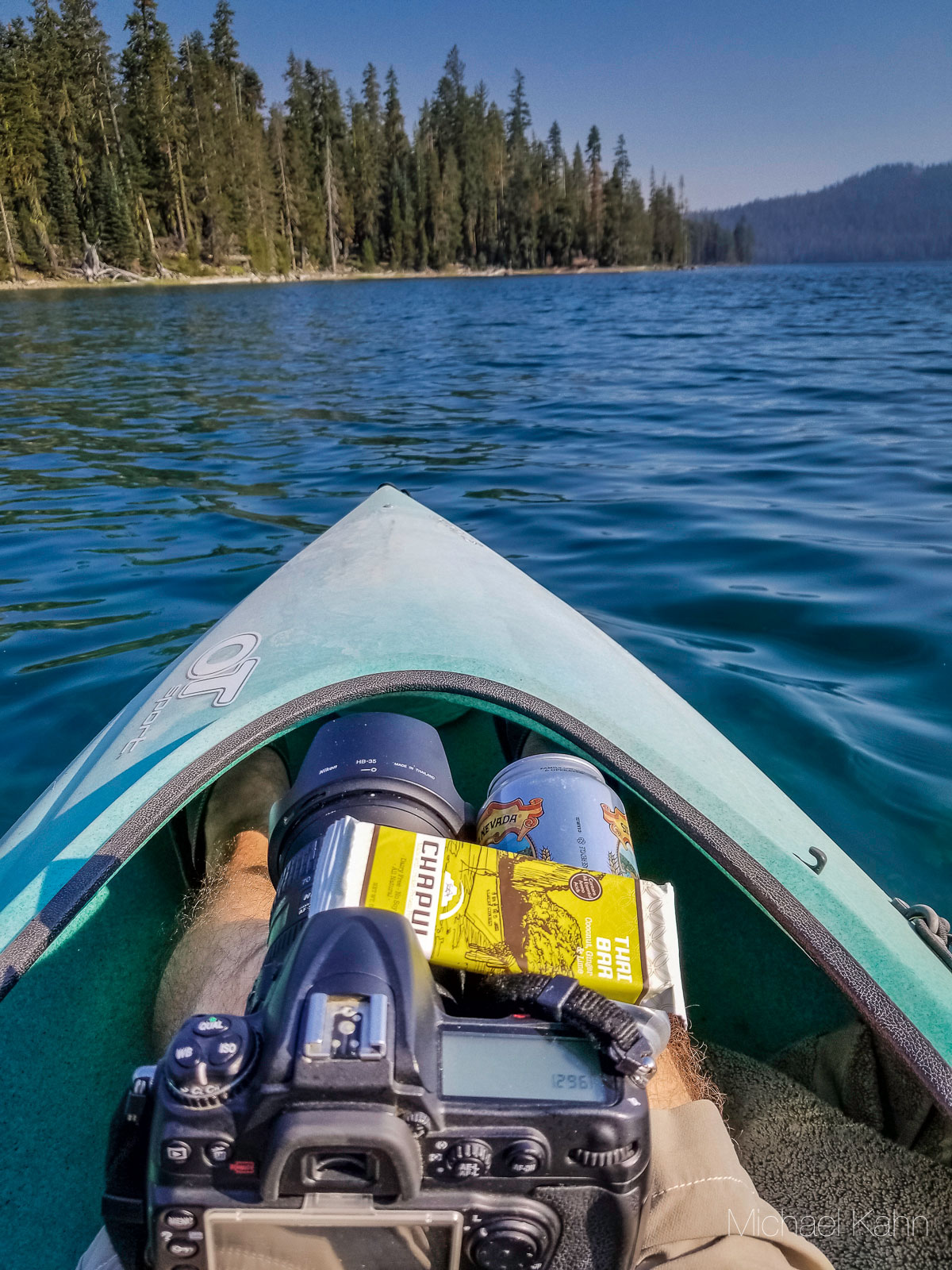
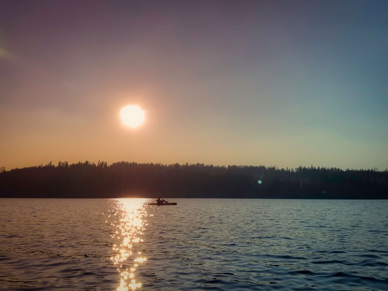
Table of Contents
- Key Takeaways
- What Is Juniper Lake?
- Current Status, 2026
- The Road from Chester
- The Lookout We Lost
- The Lake Itself
- The Cabins on the Northwest Shore
- Mt. Harkness Trail
- Juniper Lake Loop, Snag Lake, and Horseshoe Lake
- Wildlife, Wildflowers, and the Red Fir Belt
- Mountain Maidu Country
- Lassen Lake Comparison
- Where to Go Instead in 2026
- A Night Paddle in 2018
- Frequently Asked Questions
- Is Juniper Lake in Lassen Volcanic National Park open in 2026?
- What happened to the Mt. Harkness Fire Lookout?
- How long is Juniper Lake Road from Chester?
- Is there fishing at Juniper Lake?
- What is the Lassen Volcanic National Park entrance fee in 2026?
- How long is the Mt. Harkness Trail and how much elevation gain?
- Did the Dixie Fire reach Juniper Lake?
- Are the cabins at Juniper Lake still there?
- Is the Florida Juniper Lake the same as the one in Lassen Volcanic National Park?
- What is the elevation of Juniper Lake?
- What kind of volcano is Mt. Harkness?
- Whose traditional territory is Juniper Lake on?
- Article Updates
Frequently Asked Questions
Is Juniper Lake in Lassen Volcanic National Park open in 2026?
No. Per NPS Lassen Operating Hours (last updated November 17, 2025), Juniper Lake is closed with work in progress to re-open. Juniper Lake Road, Juniper Lake Campground, the two group sites, and the stock corral all remain closed for 2026 with no announced opening date. The closure dates back to the 2021 Dixie Fire, which destroyed the Mt. Harkness Fire Lookout and seven of the eight historic cabins on the lake’s northwest shore.
What happened to the Mt. Harkness Fire Lookout?
The 1930 stone-and-wood lookout was destroyed by the Dixie Fire on August 5, 2021. Listed on the National Register of Historic Places in 2017 and rehabilitated by HistoriCorps volunteers in 2019, the structure stood for 91 fire seasons before the fire crossed Mt. Harkness on its way toward Juniper Lake. Only the stone foundation likely remains at the 8,046-foot summit. NPS has not announced a rebuild plan as of May 2026.
How long is Juniper Lake Road from Chester?
NPS describes the road as 13 miles from Chester. Recreation.gov breaks down the surface as roughly six miles of rough pavement followed by seven miles of gravel. NPS recommends high-clearance vehicles for the back six miles and prohibits buses, motorhomes, and trailers. Travel time is roughly an hour at 10 to 15 mph on the gravel section. The road has been closed entirely since 2024 for post-fire recovery.
Is there fishing at Juniper Lake?
No. NPS Lassen Fishing states that Juniper Lake “does not contain any game species.” The Day Use page agrees: “There are no sport fish in the lake.” Plumas County also warns visitors not to plan a fishing trip here. For trout fishing in Lassen, head to Manzanita (catch-and-release fly fishery only), Butte, Snag, Horseshoe, or Echo Lake.
What is the Lassen Volcanic National Park entrance fee in 2026?
$30 per private vehicle from April 16 through November 30, valid for seven consecutive days. $10 in the winter season (December 1 through April 15). Motorcycle: $25 summer, $10 winter. Per person on foot or bicycle: $15 summer, $10 winter. Lassen Annual Pass costs $55. The park transitioned to a cashless fee system on April 8, 2023, so credit or debit card payment is required at entrance stations.
How long is the Mt. Harkness Trail and how much elevation gain?
NPS-canonical figures are 3.8 miles round-trip with 1,250 feet of elevation gain for the standard out-and-back. A longer combined loop pairing Mt. Harkness with the Juniper Lake outlet trail back to the campground extends the day to roughly 5.5 to 6 miles. The trailhead sits on the north side of Juniper Lake Ranger Station. With Juniper Lake Road currently closed, the trail is effectively inaccessible to day hikers in 2026.
Did the Dixie Fire reach Juniper Lake?
Yes. The Dixie Fire entered Lassen Volcanic National Park on August 5, 2021 in the southeast corner near Juniper Lake. Per NPS, “Flames from the northern tip of the fire climbed up and over Mount Harkness and claimed the fire lookout tower there on its way towards Juniper Lake.” The fire burned 73,240 acres in the park, roughly 68% of the total park area, and 963,309 acres overall, making it the largest single fire in California history at the time.
Are the cabins at Juniper Lake still there?
Seven of the eight historic family cabins on the northwest shore were destroyed in the August 2021 Dixie Fire. One cabin survived. One NPS-owned work cabin also burned. Juniper Lake Ranger Station survived because of fuel-clearing work completed earlier. The cabins predated the park’s 1916 establishment, originating from 1889 and 1892 land claims on the shore.
Is the Florida Juniper Lake the same as the one in Lassen Volcanic National Park?
No. There is a Juniper Lake near DeFuniak Springs in Walton County, Florida, managed by the county at Juniper Lake Park. That lake is unrelated to Lassen Volcanic National Park’s Juniper Lake in Plumas County, California. If a search result for “Juniper Lake” returns Florida visitor information, it is not describing this place.
What is the elevation of Juniper Lake?
NPS cites 6,800 feet for Juniper Lake. Some secondary sources use 6,700 or 6,792 feet, but NPS uses 6,800 across multiple official pages, including the Mt. Harkness Trail page (which describes the trail running from 6,800 feet at the trailhead to 8,046 feet at the summit). The lake surface itself sits a few feet below the trailhead bench.
What kind of volcano is Mt. Harkness?
USGS-mapped Mt. Harkness is a basaltic shield volcano with a summit cinder cone. It is one of four shield volcanoes at the corners of the Lassen central plateau (with Prospect Peak, Red Mountain, and Raker Peak). Mt. Harkness, Red Mountain, and Prospect Peak erupted basalt; Raker Peak erupted andesite. Each of the four developed a cinder cone on its summit during a final eruptive stage.
Whose traditional territory is Juniper Lake on?
Per NPS Lassen Volcanic’s tribal acknowledgment, the Mountain Maidu controlled the southern and eastern portions of what is now the park, including Warner Valley and Juniper Lake. Modern affiliated tribes for the Mountain Maidu include the Greenville, Enterprise, and Susanville Indian Rancherias. The archaeological record reveals evidence of human activity in the Lassen region for at least 7,500 years.
Affiliate Disclosure: Some links in this article are affiliate links to Amazon. Purchases made through these links may earn a small commission at no additional cost to you. I only recommend gear I have used or would use for this kind of trip.
Article Updates
May 5, 2026: Full Mike-byline rewrite reflecting post-Dixie Fire reality. Added current 2026 closure status (Juniper Lake Road, Campground, group sites, and stock corral all closed with no announced reopening). Updated entrance fee from $20 to $30 (cashless since April 8, 2023). Corrected road length from 12 to 13 miles per NPS. Documented destruction of Mt. Harkness Fire Lookout (1930, NRHP-listed 2017) in the August 5, 2021 Dixie Fire. Documented loss of seven of eight historic family cabins on the northwest shore. Added Mt. Harkness geologic profile (basaltic shield with summit cinder cone, USGS-mapped). Added Lassen Volcanic National Park lake comparison map and table covering nine lakes with 2026 access status. Corrected Mt. Harkness Trail figures to NPS-canonical 3.8 miles RT / 1,250 feet gain. Removed framing of Juniper Lake as a fishing destination per NPS (no game species). Added Mountain Maidu cultural context. Added 12-question FAQ with FAQPage JSON-LD schema. Added SimpleTOC. Refreshed gear recommendations to current Amazon ASINs. Personal first-person 2018 kayak narrative preserved as historical context. Sources: NPS Lassen, USGS, recreation.gov, Lassen Park Foundation, Plumas County, NOAA. Original publish date May 9, 2018 preserved.
Save this pin for your next adventure!


I’ve never actually been kayaking before. It looks like fun. That lake looks so peaceful too. Love the underwater clip in one of your videos!
Beautiful kayaking spot! My favorite kayaking trip has been in the sea caves in La Jolla, CA. Such a cool experience.
The photos just speak for themselves such a beautiful place would love to visit one day.
What a beautiful spot to go kayaking!
These photos look amazing! I am going to add this to our family bucket list, we love a good adventure!
Ahh this looks so beautiful! I can’t get over those views! Not sure if I’d be able to take the plunge kayaking because I’m not the most confident swimmer, if anything were to happen (lol) but other than that, this looks like it’d be an incredible experience!
-Madi | http://www.everydaywithmadirae.com
I was just saying the other day how would I would love to go kayaking. But I do not know how to swim. This looked like a wonderful trip, the views are beautiful.