
The most important choice at Folsom Lake happens before you see the water: which of the six gates you drive to.
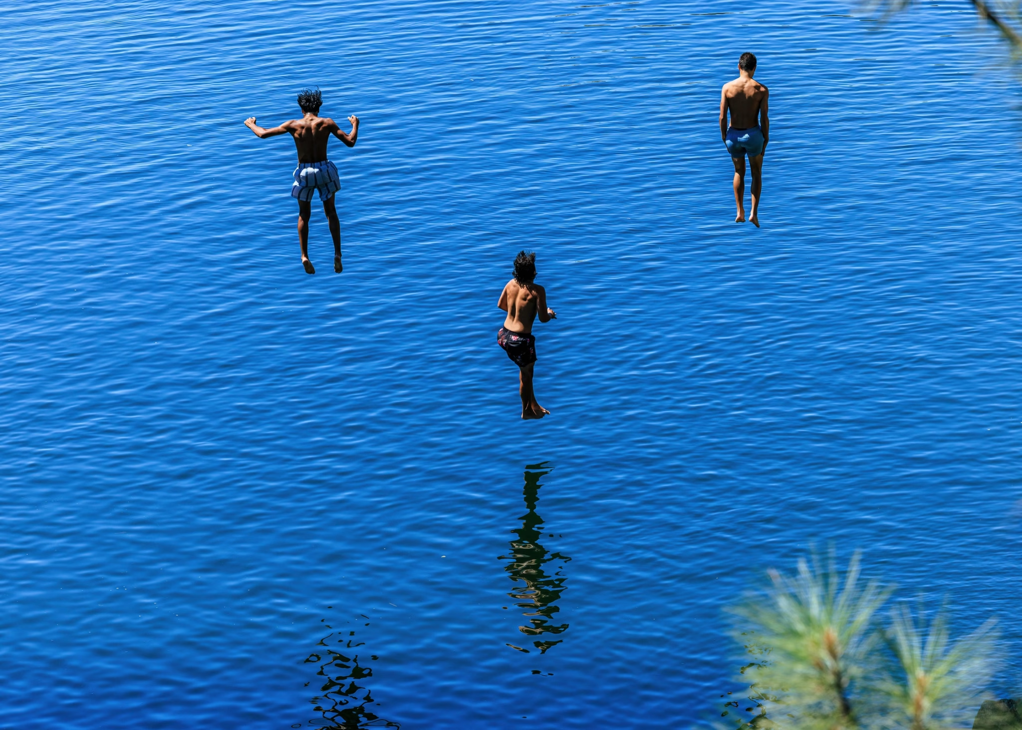
Get it right and the day sorts itself out, a swim beach or a boat ramp or a quiet cove, exactly as you pictured. Get it wrong and you are looping the long way around the lake to fix it, or hauling a cooler across a quarter mile of dried mud to reach the water.
Four things decide whether a Folsom day goes well: which entrance fits the trip, what it costs, when to show up, and what the lake is actually doing that week.
That last one matters most. Folsom is a flood-control reservoir, drawn down every fall and refilled by spring snowmelt, so the level swings hard between seasons.
The water can lap the parking lot in May and sit a hundred yards back across cracked red dirt by September. Check the live level before you go.
The recreation area covers 19,500 acres roughly 25 miles east of Sacramento, off Highway 50 or Interstate 80. State Parks counts about two million visitors a year across its two reservoirs, Folsom and Natoma.
The lake itself is a reservoir on the American River, fed by the North Fork and the South Fork, which is why it splits into two long arms. Below the dam it becomes Lake Natoma, the calm afterbay where the paddlers go. Upstream, past Auburn, the North Fork climbs toward Lake Clementine.
Settle those four questions first, and Folsom is one of the best summer days near Sacramento.
Key Takeaways
- Six main ways in, three counties: Granite Bay and Beals Point hold the busiest swim beaches, Brown’s Ravine has the marina, and Folsom Point, Peninsula, and Rattlesnake Bar round out the gates. The park spans Sacramento, Placer, and El Dorado counties, about 25 miles east of the city.
- The water level swings hard: Folsom is a flood-control reservoir on a snowmelt river, drawn down every fall and refilled in spring. Check the live level at CDEC station FOL before you go, especially if you plan to launch a boat.
- No lifeguards, real risks: State Parks warns that the water “may look calm” but “has claimed lives in the past.” Seasonal cyanobacteria blooms have sickened dogs. Swim at your own risk, and keep kids and pets out of any discolored or scummy water.
- Golden mussel seals since May 14, 2025: Every trailered or motorized boat has to arrive with a seal intact and verified, and there are two ways to get one: a mandatory 30-day quarantine, or a hot-water decontamination at an approved station, which lets you launch the same day. Quarantine is not an alternative to the seal; it is one of the two routes to it. Inspections run at Granite Bay. Kayaks, canoes, paddleboards, outriggers, rowing shells and row boats are exempt.
- Two very different campgrounds: Beals Point has 49 family campsites plus 20 RV hookup sites, open year-round, for trailers and motor homes up to 31 feet. Peninsula has a hundred family campsites reached by boat or a 10-mile drive from Pilot Hill, trailers limited to 18 feet and motor homes to 24. Both book through ReserveCalifornia.
- Fees and hours (as of June 2026): Day use runs $12 per vehicle at the main gates, $10 at the smaller ones, with a $10 boat launch. Summer gates open at 6 or 7 AM and close 30 minutes after sunset; Brown’s Ravine stays open until 9 PM.
- Ride to it or look beneath it: The 32-mile American River Bike Trail ends at Beals Point, linking the lake to Old Sacramento. And the Gold Rush town of Mormon Island still lies on the lakebed, surfacing in drought years.
The Six Ways In: Folsom Lake’s Access Points
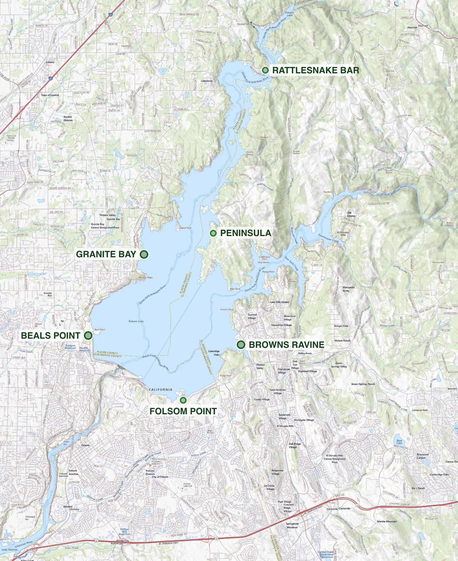
The single most useful thing to know about Folsom is that the entrance you pick decides your whole day. The lake is too big to have one front door.
Each gate opens onto a different stretch of shoreline with its own personality, and showing up at the wrong one means a long drive around to fix it. Here is how the main access points sort out.
Granite Bay
Busiest day-use
Big swim beaches, multiple parking lots, a boat launch, and the vessel inspection station. Fills first on hot Saturdays.
Beals Point
The all-rounder
Marquee swim beach, the lake’s only year-round campground (49 family sites plus 20 with hookups), and the north end of the bike trail.
Brown’s Ravine
The marina
Folsom Lake Marina with boat and jet-ski rentals, fuel, and slips. The boating hub, and the one gate open until 9 PM.
Folsom Point
Quiet south shore
A calmer boat launch and day-use spot for when Granite Bay is a zoo. Limited beach.
Peninsula
Remote camping
A hundred family campsites between the two arms, reached by a 10-mile road from Pilot Hill. A swim beach far from the crowds.
Rattlesnake Bar
Quiet north end
Hand launch and trails up the North Fork arm, favored by anglers and kayakers who would rather not share.
Granite Bay
Granite Bay is the front door most people use, the largest day-use area on the lake and the one that fills first on a hot Saturday.
It has broad beaches, multiple parking lots, a boat launch, and the kind of shallow, gradual entry that families gravitate toward. It is also where the current vessel inspection station lives, so if you are towing a boat, this is usually your stop.
Get there before 11 AM in July or accept a long walk from the water. And there is almost no natural shade on the beach, which is the one thing first-timers underestimate. A pop-up shade tent earns its trunk space here more than any other piece of gear.
Beals Point
Beals Point is the all-rounder.
It has the marquee swim beach near the dam and the lake’s only year-round campground, and it anchors the northern end of the paved American River Bike Trail. If you want to do a little of everything in one trip, or camp without driving to the back of beyond, this is the gate.
The beach here, like most of the lake’s shoreline, turns rocky and exposed as the water drops, so a pair of water shoes saves a lot of tender-footed hopping across the cobbles in late summer.
Brown’s Ravine and the Marina
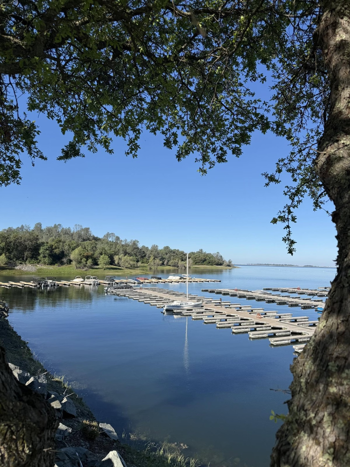
Brown’s Ravine, on the South Fork arm, is the boating capital of Folsom. It holds the Folsom Lake Marina, the only full marina on the lake, with slips, fuel, and the rental fleet that makes a boat-less day on the water possible. It is also the one gate that stays open late, until 9 PM in summer, which matters if you want an evening cruise and not a race against the sunset closure.
If your plan involves anything with a motor, start here.
Folsom Point, Rattlesnake Bar, and the Quieter Gates
The rest of the entrances trade amenities for elbow room. Folsom Point, on the south shore east of the dam, has been the calmer launch and day-use spot when Granite Bay is a zoo. State Parks has it closing to boat launching on August 16, 2026, so check the park’s Boat Launch Status page before you tow anything there. That page is worth a look regardless: Granite Bay Stages 1 and 3 and the low-water ramp are closed, Peninsula South is closed, and neither Rattlesnake Bar nor Peninsula will take a motorized boat for the summer 2026 season. Rattlesnake Bar, up at the north end off Auburn-Folsom Road, opens onto the quiet upper reaches of the North Fork arm, with trails and a hand launch favored by anglers and kayakers who would rather not share.
None of these will be empty on a holiday weekend. They just reward anyone willing to drive a few extra minutes to escape the main crush.
A point the park map muddies: a few of the recreation area’s other entrances, including Willow Creek and Nimbus Flat, sit on Lake Natoma below the dam, not on Folsom Lake itself.
Boating, Jet Skis, and the Marina
Folsom is a good boating lake when it is full, with two long arms that give powerboats and personal watercraft room to spread out. Jet skis are popular enough that “jet ski Folsom” is one of the most searched things about the lake, and the open water off Brown’s Ravine and the lower South Fork arm is where most of that happens.
No boat of your own is no problem.
The Folsom Lake Marina at Brown’s Ravine and Granite Bay Rentals both put boats and watercraft on the water by the hour or the day. Rental fleets and operators shift from season to season, so confirm what is available before you build a trip around it.
One thing you cannot skip if you are trailering your own boat: the golden mussel inspection. Since May 14, 2025, every trailered or motorized vessel has to reach the water with a seal intact and verified. There are two routes to one: a mandatory 30-day quarantine, or a hot-water decontamination at an approved station that clears you to launch the same day.
Golden mussels are an aggressive invader new to North America, first found in the Delta in late 2024. In May 2025 a boat arriving from the Delta was caught with live mussels still aboard before it ever touched Folsom’s water. The lake superintendent put it plainly: “we prevented this vessel from ever touching the water, which could have had catastrophic consequences.”
The inspection station has already moved once, from Beals Point to Granite Bay, so check the Folsom Lake SRA page for the current location and hours before you hitch up. Kayaks, canoes, and paddleboards are exempt.
Swimming and the Beaches
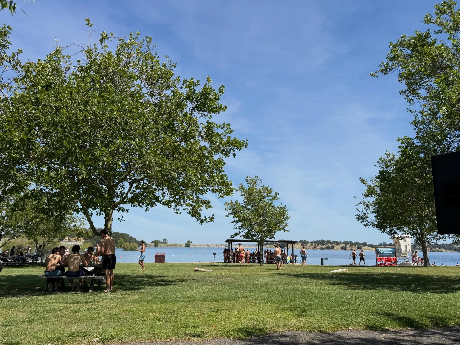
Yes, you can swim in Folsom Lake, and on a summer afternoon thousands of people do, mostly at the Granite Bay and Beals Point beaches.
⚠ Before you get in
- No lifeguards anywhere. The water has claimed lives. Bring flotation for weak swimmers and keep an eye on kids.
- Watch for algae. If the water looks scummy, discolored, or bright green, stay out and keep kids and dogs clear.
- No dogs in the swim areas. Granite Bay, Beals Point, Black Miners Bar, and Nimbus Flat.
Water quality advisory in effect
On July 1, 2026, California State Parks and the Central Valley Regional Water Quality Control Board posted an advisory for elevated E. coli at three of the spots covered on this page: Willow Creek, Nimbus Flats, and Black Miners Bar Day Use Beach. Late-June samples came back high at near-shore locations, and testing continues through the summer.
Nothing is closed, and paddling is a different kind of exposure than swimming. What the advisory asks of you: stay out of the water with an open wound, shower afterward, rinse the dog with clean water and bring drinking water so they are not lapping from the lake, and drink nothing from the lake yourself. Dogs are the ones to watch, since they will happily swallow whatever is in the shallows.
Check the current status before you plan a beach day: the State Parks advisory and weekly results on the SWAMP recreational water quality page.
What you should know first is that there are no lifeguards anywhere on the lake. State Parks does not soften it: “Though the water may look calm, it has claimed lives in the past.” The water warms up nicely by midsummer in the shallows, but it gets deep and cold fast off the points, and the level shifts the bottom contour from one month to the next. Watch your kids, bring flotation for weak swimmers, and treat the open water with respect.
The other seasonal hazard is harmful algal blooms. In warm, low-water stretches the lake can grow cyanobacteria, and suspected blooms have been tied to dog illnesses at Mooney Ridge on Folsom and nearby Oregon Bar. The rule is simple: if the water looks scummy, discolored, or bright green, stay out of it, and keep dogs and children well clear.
Dogs, by the way, are welcome on the trails and in the water generally. They are banned only from the designated swim beaches at Granite Bay, Beals Point, Black Miners Bar, and Nimbus Flat.
Camping at Folsom Lake
There are two campgrounds, and they could not be more different. Beals Point is the easy one: 49 family campsites plus 20 RV hookup sites, open year-round, with room for trailers and motor homes up to 31 feet, a short walk from the beach and the bike trail. It books up fast for summer weekends, so reserve early through ReserveCalifornia.
Peninsula is the wild one.
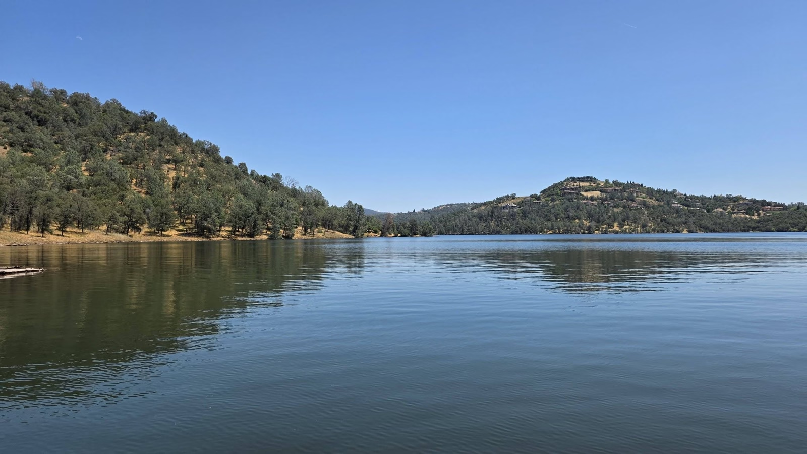
Its hundred sites sit out near the tip of the finger of land between the North and South Fork arms, and you reach them either by boat or by a 10-mile drive in from Pilot Hill off Highway 49. Trailers are capped at 18 feet, motorhomes at 24, and the access road is subject to winter closure. It is not the place for a big rig or a last-minute plan. It is exactly the place if you want a quiet, water’s-edge site away from the crowds and you are willing to work a little for it.
Both campgrounds, and the group sites that run higher, reserve through the same ReserveCalifornia system.
Hiking, Biking, and the American River Bike Trail
The park holds 95 miles of trail for hiking, mountain biking, and horseback riding, threading the oak-and-grassland foothills above the shoreline. The headline route, though, is paved and famous.
The Jedediah Smith Memorial Trail, better known as the American River Bike Trail, runs 32 mostly flat miles from Discovery Park in Old Sacramento all the way to Beals Point at Folsom Lake. Riding it from the city to the lake is one of the best long, car-free days the region offers, and it ties Folsom directly into the calmer water of Lake Natoma downstream, where a lot of the area’s paddleboarding happens.
If you are going to put in real trail miles in the foothill heat, carry more water than feels reasonable. A hydration bladder beats trying to ration a couple of bottles.
Fishing Folsom Lake
Folsom is a working fishery with a split personality. It is a warmwater bass lake first, holding both largemouth and smallmouth, along with catfish and perch. It is a managed coldwater fishery too, with trout plus the landlocked kokanee and Chinook salmon that the Department of Fish and Wildlife stocks into Central Valley reservoirs. The bass fishing draws tournament anglers; the kokanee draws the downrigger crowd in spring and early summer.
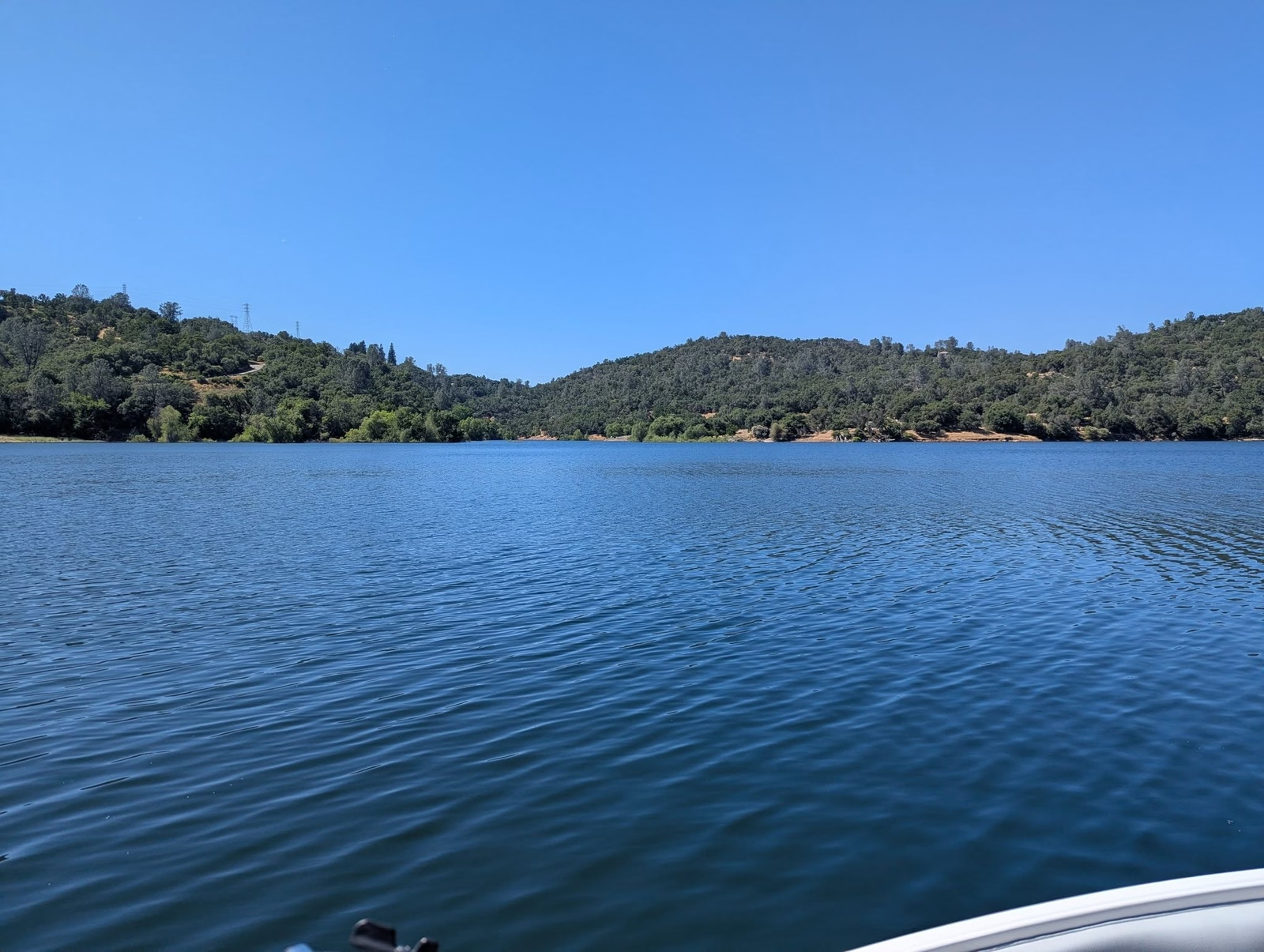
You will need a valid California fishing license, and a decent pair of waterproof binoculars helps you read the water and spot the bird activity that flags where the fish are working. As with everything on this lake, the falling water level moves the productive structure around through the season, so what worked in May may be high and dry by August.
Gold Panning and the Town Under the Lake
This is Gold Rush country, and the lake sits on top of its history.
Mormon Island, the drowned town under the reservoir, was the first major strike after James Marshall’s discovery at Coloma, settled in 1848 by members of the Mormon Battalion. When Folsom filled in 1955, the townsite went under, and it has been surfacing in drought years ever since, foundations and all.
You can still pan for gold in the recreation area, and people do find flakes. The rules keep it low-impact: hand pans only, no sluices or motorized equipment, a cap of 15 pounds of material per person per day, and nothing sold commercially. It is a good, cheap way to put a kid’s hands in the river and connect a beach day to the bigger story of why this place exists at all.
Water Levels: Why Folsom Is Never the Same Lake Twice
Folsom Dam was built by the Army Corps of Engineers, completed in 1956, and is operated by the Bureau of Reclamation as part of the Central Valley Project. Its first job is flood control. That single fact explains the lake’s wild mood swings better than anything else.
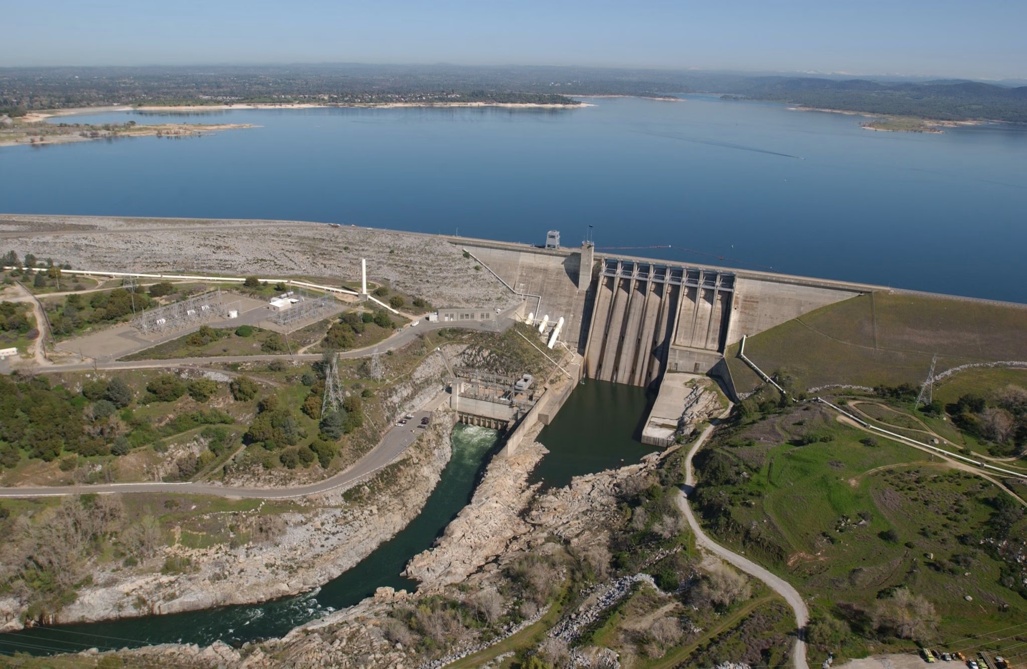
Every fall the operators draw the reservoir down on purpose to make room for winter storm runoff, then let the spring snowmelt refill it. In a good water year it climbs back toward full pool at 466 feet of elevation and just over a million acre-feet of storage. In a drought it can fall far enough to strand boat ramps and re-expose Mormon Island.
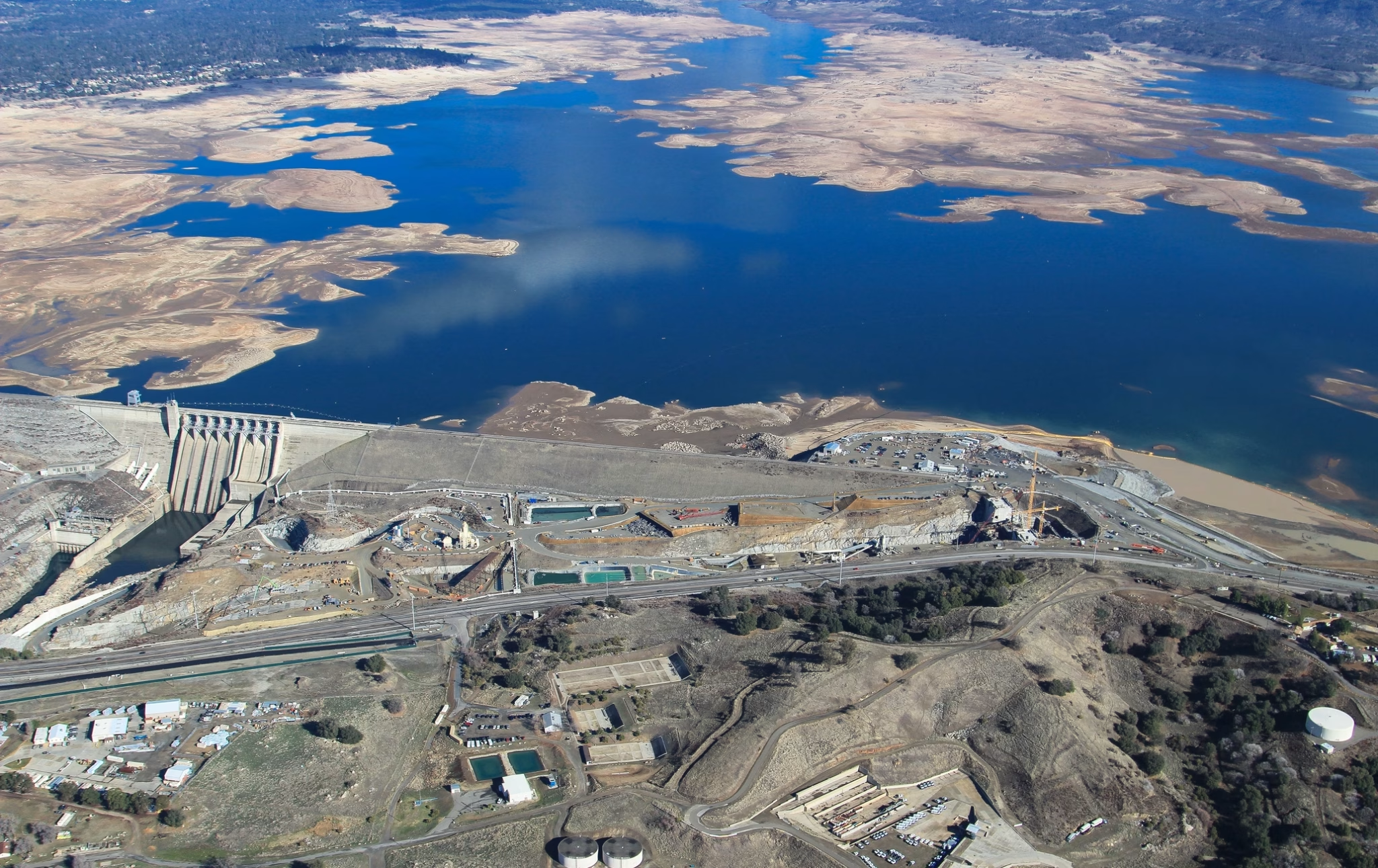
So do not trust a number in any article, including this one, about how full the lake is. It can swing tens of feet in a single season.
Check it live before you go, especially if you are launching a boat or counting on a low-water ramp. The state’s CDEC station FOL shows real-time storage and elevation, and the Central Valley Operations daily reports track the bigger picture. Five minutes on those pages is the difference between a great day and a long, dusty walk to find the water.
Know Before You Go: Fees, Hours, and Dogs
- Day-use fee: $12 per vehicle at the premium gates (Granite Bay, Beals Point, Brown’s Ravine, Folsom Point, Peninsula, Rattlesnake Bar), $10 at the smaller entrances. Boat launch is $10. Fees are current as of June 2026 and do change, so confirm on the State Parks fee page.
- Gate hours: In summer (April 1 to November 1) most gates open at 6 or 7 AM and close 30 minutes after sunset. Brown’s Ravine stays open until 9 PM. In winter, gates open at 7 AM. Hours shift seasonally; the hours page is the source of record.
- Dogs: Welcome on leash on the trails and in the water generally, but not in the designated swim areas at Granite Bay, Beals Point, Black Miners Bar, or Nimbus Flat.
- Camping reservations: Beals Point and Peninsula both book through ReserveCalifornia.
- Live water level: CDEC station FOL.
Frequently Asked Questions
How deep is Folsom Lake?
At full pool, Folsom Lake reaches a maximum depth of about 335 feet near the dam, with a full-pool surface elevation of 466 feet above sea level. Because it is a flood-control reservoir that is drawn down every year, the actual depth at any given time can be far less. Check CDEC station FOL for the current level.
Is Folsom Lake man-made?
Yes. Folsom Lake is a reservoir on the American River, created by Folsom Dam. The dam was built by the U.S. Army Corps of Engineers, completed in 1956, and is operated by the U.S. Bureau of Reclamation as part of the Central Valley Project. The lake first began storing water in 1955.
Can you swim in Folsom Lake?
Yes, and the main swim beaches are at Granite Bay and Beals Point. There are no lifeguards anywhere on the lake, and State Parks warns that the water has claimed lives. Seasonal harmful algal blooms can also occur, so avoid any scummy or discolored water and keep kids and dogs out of it.
What time does Folsom Lake open and close?
In summer (April 1 to November 1), most gates open at 6 or 7 AM and close 30 minutes after sunset, with Brown’s Ravine open until 9 PM. In winter (November 2 to March 31), gates open at 7 AM and close 30 minutes after sunset. Hours change seasonally, so confirm on the State Parks hours page.
How much does it cost to get into Folsom Lake?
Day use is $12 per vehicle at the main gates (Granite Bay, Beals Point, Brown’s Ravine, Folsom Point, Peninsula, Rattlesnake Bar) and $10 at the smaller entrances, with a $10 boat launch fee. Fees are current as of June 2026 and are subject to change.
Are dogs allowed at Folsom Lake?
Yes, dogs are allowed on leash on the trails and in the water in general. However, they are not permitted in the designated swim areas at Granite Bay, Beals Point, Black Miners Bar, or Nimbus Flat.
What fish are in Folsom Lake?
Folsom holds largemouth and smallmouth bass, catfish, perch, and trout, and it is a managed kokanee and landlocked Chinook salmon fishery stocked by the Department of Fish and Wildlife. A valid California fishing license is required.
Can you rent a boat or jet ski at Folsom Lake?
Yes. The Folsom Lake Marina at Brown’s Ravine and Granite Bay Rentals offer boats and personal watercraft by the hour or day. Operators and fleets change seasonally, so confirm availability before your trip. Trailered and motorized boats must pass a golden mussel inspection before launching.
Is Lake Natoma part of Folsom Lake?
Not exactly. Lake Natoma is a separate, smaller reservoir directly downstream of Folsom Dam that acts as an afterbay, regulating water released from Folsom before it continues past Nimbus Dam to the lower American River. Natoma has a 5-mph speed limit and is hand-launch only, which makes it popular for kayaking and paddleboarding.
Can you camp at Folsom Lake?
Yes. Beals Point has 49 family campsites and 20 RV hookup sites, open year-round, for trailers and motor homes up to 31 feet. Peninsula has a hundred family campsites reached by boat or a 10-mile drive from Pilot Hill, with trailers limited to 18 feet and motor homes to 24. Both reserve through ReserveCalifornia.
Is there gold in Folsom Lake?
Yes. The lake sits in Gold Rush country, on top of the drowned mining town of Mormon Island. Recreational gold panning is allowed using hand pans only, with no motorized equipment, a limit of 15 pounds of material per person per day, and no commercial sale.
What county is Folsom Lake in?
Folsom Lake State Recreation Area spans three counties: Sacramento, Placer, and El Dorado. The lake sits about 25 miles east of Sacramento, reachable via Highway 50 or Interstate 80.
Affiliate Disclosure: Some links in this article are Amazon affiliate links. If you buy a product through these links, we may earn a small commission at no additional cost to you. This helps support MK Library and allows us to continue creating honest, experience-driven content.
Article Updates
August 7, 2026: Operational currency pass against California State Parks sources. Added the closure of Folsom Point to boat launching on August 16, 2026, along with the other ramps currently down. Corrected the park size from about 18,000 acres to 19,500, annual visitation from more than 2.5 million to about two million across both reservoirs, and the trail network from roughly 50 miles to 95, all per the park brochure. Corrected the campground counts: Beals Point has 49 family campsites and 20 RV hookup sites rather than 69 hookup sites, and Peninsula has a hundred family campsites rather than 85, with motor homes limited to 24 feet. Removed a boat launch attributed to Beals Point, which appears on neither the brochure’s launch list nor the park’s Boat Launch Status page. Corrected the golden mussel seal requirement from April 14, 2025 to May 14, 2025 and rewrote it: a 30-day quarantine is not the alternative to holding a seal, it is one of two routes to one, the other being hot-water decontamination for a same-day launch. Reattributed CDEC station FOL to the state rather than the Bureau of Reclamation; CDEC is run by the Department of Water Resources.
August 4, 2026: Added the California State Parks health advisory posted July 1, 2026 for elevated E. coli at Willow Creek, Nimbus Flats, and Black Miners Bar Day Use Beach.
June 7, 2026: Replaced the access-point map with a USGS topographic map at retina resolution and plotted the six main reservoir access points at their true coordinates. Corrected the access-point list: Willow Creek is an entrance on Lake Natoma, not Folsom Lake, so it was removed from the Folsom Lake gates and noted in its place. Added two public-domain aerial photos (Folsom Dam and the reservoir at low water).
June 3, 2026: Original publication. Complete adventure guide to Folsom Lake covering the six main reservoir access points, boating and the marina, swimming and beach safety, camping at Beals Point and Peninsula, the American River Bike Trail, fishing, gold panning and the Mormon Island history, water-level volatility, and fees and hours. Includes a custom access-point map, a comparison table, and a 12-question FAQ with structured data. All facts sourced from California State Parks, the U.S. Bureau of Reclamation, CDEC, and the Department of Fish and Wildlife. Fees and gate hours current as of this date; golden mussel inspection requirements reflect the program as of the 2025 launch.